
If you are itching to get outside in nature, it is time to go for a hike, bike ride, or stroll on one of the many miles of walking trails in Rhode Island. A family hike is one of our favorite outdoor activities, so we have put together this guide to where to go walking/hiking in Rhode Island.
Most hiking in RI isn’t too strenuous, but I’ve made sure to include our notes on the terrain, parking situation, and what you need to know before you go.

Best Walking Trails in Rhode Island
Rhode Island may be the smallest state, but there is still a lot of ground to cover. I understand that you may want to find the trails closest to you so we have broken our recommendations down by region.
Trails in Northern Rhode Island
Cumberland Monastery

The Cumberland Monastery Path is co-located at the Cumberland Library and there is typically plenty of parking. You can download a map of the trails online, but if you follow the trail past the playground it is fairly easy to follow the main loop around the Monastery grounds.
We typically follow the Nine Men’s Misery Trail to the Field Trail to Old Road Trail to the Beauregard Trail. It sounds more complicated than it is! This predominantly flat, well-worn dirt or gravel trail is about two miles altogether.
Keep in mind that it can be muddy in the spring and buggy in the summer. I would recommend bug spray, wearing a hat, checking for ticks after, and keeping an eye out for slithering critters. You will also encounter a few streams and ponds where you can spy turtles and lately, I’ve been lucky to spot a few deer. Animals are allowed on leash.
The Cumberland Monastery is located at 1464 Diamond Hill Rd, Cumberland, RI 02864.
Blackstone Valley Bike Path

The Blackstone Valley Bike Path is great for walkers and bikers. Depending on where you start, you can wander past water thundering over dams, quiet canals filled with wildlife, or alongside train tracks.
This path runs approximately 11 miles from Lincoln to Woonsocket, with an intent to eventually extend it to connect into Massachusetts and down to the East Bay Bike Path. There are numerous entrance points, but one of the largest parking lots is at the Front Street Parking Area.
Blackstone Valley Bike Path Front Street Parking Area is located at 160 Front Street, Lincoln, RI.
Lincoln Woods State Park

Just off of Route 146 in Lincoln, Lincoln Woods State Park offers picnic areas, a freshwater beach, trout fishing, hiking, jogging/walking trails, horseback riding, and even bouldering. Parking can be limited on the weekend but there are various lots to try.
You can go “off trail” and find some great bouldering sites or stick to the main 2.5 mile loop around the lake. This paved trail offers some elevation but nothing too strenuous. You can enjoy pretty views over the lake and a primarily shaded path. Keep in mind that as a state park, this is carry in/carry out — including your dog waste!
Lincoln Woods is located at 2 Manchester Print Works Road, Lincoln, Rhode Island 02865
Diamond Hill Park
Diamond Hill Park in Cumberland used to be a ski area. For those looking for elevation, it offers a summit of 481 feet. From the top, on a clear day, you may be able to spy the Boston skyline. Diamond Hill Park is used for local sports, seasonal food truck events, live concerts, and festivals.
The smaller hill on the left is an easier hike with walking trails offering views of the Diamond Hill Reservoir. The trails are steep and not well marked so you may want to bring a GPS as they aren’t great for for casual walkers.
After your walk, treat yourself to ice cream at the Ice Cream Machine across the street.
Diamond Hill Park is located at 4097 Diamond Hill Rd. Cumberland RI 02864
Trails near Providence
Ten Mile Greenway
The Ten Mile Greenway, which runs adjacent in part to Slater Memorial Park in Pawtucket, is actually only three miles long. It is best to park along the road on Armistice Boulevard and pick up the trail from there.
The trail connects the park with athletic fields and winds through the woods and along the James Turner Reservoir. That section can get a little buggy in the warmer weather so I highly recommend putting on bug spray before you venture out. The path is paved and you can easily add in a family picnic or stroll through Slater Park.
Ten Mile Greenway is located off Armistice Boulevard in Pawtucket.
Blackstone Valley Boulevard

Popular with walkers and joggers on Providence’s East Side, the “Boulevard” is often crowded so it is best to go at off-peak hours. This gravel trail runs about 1.5 miles in the middle of Blackstone Boulevard, with small inclines along the way. This trail is not for hikers, but those who want to enjoy a pretty stroll through Providence.
Street parking is available on both sides of Blackstone Valley Boulevard. In the spring and summer, you will find a farmer’s market in Lippitt Memorial Park off the Boulevard on Saturday mornings and Wednesday afternoons.
Caratunk Wildlife Refuge
Located in nearby Seekonk, MA, the Caratunk Wildlife Refuge is managed by the Audubon Society of Rhode Island. The Refuge offers meandering trails along running brooks with a mix of dirt trails, boardwalks, and bridges.
There are nearly 200 acres of fields, forests, streams, and ponds and miles of well-marked trails. Ideal for hiking and bird watching, you can also snowshoe or cross-country ski in the winter. Keep in mind that as a wildlife refuge, there are no pets allowed on the trails. The trails can also be muddy in the spring or wet weather.
Caratunk Wildlife Refuge is located at 301 Brown Ave, Seekonk, MA 02771
Powder Mill Ledges Wildlife Refuge
Powder Mill Ledges in Smithfield is also the Rhode Island headquarters of the Audubon Society. This refuge covers 100 acres of woodlands for hiking, birdwatching, and, in the winter, snowshoeing.
It is a well-marked loop, about 2-2.5 miles in total, but you will want to wear hiking boots for climbing over roots and especially if the trail gets muddy.
Powder Mill Ledges is located at 12 Sanderson Road (Rt.5), Smithfield, RI 02917
Wolf Hill Forest Preserve
Wolf Hill Forest Preserve has multiple well-marked trails, the best known of which is the 4.4-mile World War II Memorial Loop. There is a memorial to three U.S. Army Air Corps men who died there in a 1943 plane crash along the loop. The Mary Mowry Trail is the most challenging, which is steep and rocky.
Most of the trails are old farm roads through forests. But if walking through the woods or up the steeper trails, you will want to wear hiking boots for walking over roots and rocks.
Wolf Hill Forest Preserve is located on Waterview Drive in Smithfield, RI
East Bay Bike Path

While ideally designed for bikers, you can also walk along the 12.5-mile East Bay Bike Path. Pick up the path at various points or park near India Point Park or Colt State Park.
This paved path passes water and through towns like Barrington and Bristol. Just pay attention when walking on a busy day to give cyclists the right of way.
Roger Williams Pond Trail

Located in the popular Roger Williams Park, the Pond Trail loops 3.8 miles along the lake. Parking is available in the lot near the carousel and then you can cross over the road to start the trail.
Rocky Point Trail
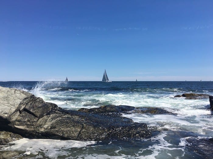
Located on the site of the old Rocky Point Amusement Park, the Rocky Point Trail is a 1.6-mile loop with beautiful views of Narragansett Bay. The trail is paved and fairly flat, with areas to wander off to look for seaglass on the beach or climb on the rocks
Keep in mind that there isn’t a lot of shade and dogs need to be kept on a leash.
Rocky Point Trail is located at 33 Rocky Point Ave, Warwick, RI 02889
Trails in Southern Rhode Island
Carr’s Pond
Part of the Big River Management area, there are numerous trails around Carr’s Pond in East Greenwich including the four-mile loop around the pond. If you want to spend more time you can explore the various loops and side trails.
There are lots of roots and rocks to climb over, so hiking boots are recommended, especially when it is muddy. Be sure to bring the bug spray if you are visiting in the summer.
Carr Pond is located in the Big River Management Area in West Greenwich, RI
Claire D. McIntosh Wildlife Refuge

Home to the Audubon Society of Rhode Island, the Claire D. McIntosh Wildlife Refuge also offers up a nature center and small aquarium. However, there is also a one-mile trail that winds through a wildflower meadow, across the East Bay Bike Path, through the woods, and over wetlands on a boardwalk. The path ends with an overlook of the salt marshes.
The Claire D. McIntosh Wildlife Refuge is located at 1401 Hope Street, Bristol, RI
Sachuest Point National Wildlife Refuge

Down at the tip of Rhode Island overlooking Sachuest Bay and the Atlantic Ocean, this 242-acre wildlife refuge offers easy, gentle trails with beautiful water views. There is a fairly large parking lot, but it still gets very crowded on nice days and in high season. The visitor center offers exhibits about the 200 bird species that call the refuge home, at least seasonally. Restrooms are also available during the day.
There is a 2.4-mile loop trail, which is two loops that intersect so you can opt for a shorter hike if you like. Just leave plenty of time to venture off the path to climb on the rocks and take in the views.
The Sachuest Point National Wildlife Refuge is located in Middletown, RI
Newport Cliff Walk

The Newport Cliff Walk is one of the most famous attractions in Rhode Island and is designated a National Recreation Trail. This 3.5-mile trail follows the Newport shoreline and traces the backyards of some of the most famous Newport Mansions.
The trail is fairly narrow and flat, although the southern portion gets rougher and rockier. Portions of the Cliff Walk have been washed away and long detours may be required if you want to walk the whole thing.
Parking can be a challenge at either end. The walk starts at the western end of Easton’s (First) Beach at Memorial Boulevard and runs to the Forty Steps, then from Forty Steps to Ruggles Avenue. From Ruggles Avenue to Belmont Beach, then Belmont Beach to Ledge Road. Finally, Ledge Road to Bellevue Avenue.
Norman Bird Sanctuary

The Norman Bird Sanctuary in Middletown covers 300 acres and seven miles of marked hiking trails, some of which are fully accessible. The Sanctuary offers guided bird walks and free nature walks, but generally, you do need to pay a trail access fee, except for members.
Various trails wind through the gardens and woods, but you can take the Hanging Rock Trail for a little rock scramble for beautiful views of the pond and Second Beach.
The Norman Bird Sanctuary is located at 583 Third Beach Road, Middletown, RI 02842
Beavertail State Park
One of our favorite spots in Rhode Island, Beavertail State Park is located at the southern tip of Jamestown. There is a 2.3-mile loop trail, but the real fun is climbing down onto the rocks and poking around in the tide pools.
It is also a picturesque spot with stunning views and a small lighthouse. In the summer, they also operate a tiny aquarium of local sea life. Because of the location and wind, this is also a perfect spot to fly a kite on a breezy day.
Beavertail State Park is located on Beavertail Rd, Jamestown, RI 02835
Trustom Pond National Wildlife Refuge
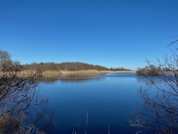
Spread over 787 acres with a closed lagoon, the Trustom Pond National Wildlife Refuge offers two miles of walking trails with many opportunities for bird watching and wildlife viewing. The parking lot is small so plan on arriving at off peak times to secure a spot.
Trustom Pond National Wildlife Refuge is located in South Kingstown.
Ninigret National Wildlife Refuge
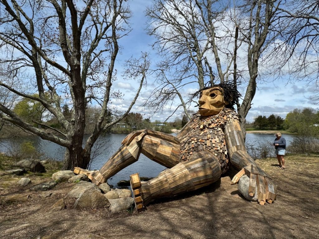
Ninigret National Wildlife Refuge now has two more reasons to take a walk there with the introduction of two of Thomas Dalbo’s giant trolls. You can find Erik Rock near Ninigret Pond across from the Frosty Drew Observatory. Then, take it as a challenge to walk through the park to find Greta Grant.
Trails in Western Rhode Island
Long Pond Woods
Scenes from Wes Anderson’s “Moonrise Kingdom” starring Bill Murray and Bruce Willis were filmed on this trail. Operated by the Audubon Society, Long Pond Woods is one of Rhode Island’s more challenging hikes. The trail takes you into a 218-acre conservation area with rock formations, wetlands, a cedar bog, and a forested valley.
A steep hike up to rocky cliffs offers views of both Long Pond and Ell Pond in the hollow below. Parking is available at the Audubon Society building or along the road.
Long Pond Woods is located at North Road, Rockville, RI 02873
Acadia Management Area
Arcadia Management Area offers 11 main trails ranging from easy to moderate. One of the most popular is the 2.7-mile Ben Utter Trail to Stepstone Falls. This meanders along a river and past an old grist mill to Stepstone Falls.
Acadia Management Area is located off Austin Farm Road in Exeter, RI
Looking for more to do in Rhode Island?
- Favorite things to do in Rhode Island in the spring
- Favorite things to do in Rhode Island in the summer
- Favorite things to do in Rhode Island in the fall
- Favorite things to do in Rhode Island in the winter
- Apple picking in Rhode Island
- Pumpkin patches in Rhode Island
- Corn mazes in Rhode Island

Tamara Gruber is the Founder and Publisher of We3Travel. A former marketing executive and travel advisor, Tamara is an award-winning travel writer and recognized expert in family travel. Tamara is a member of SATW, NATJA, IFWTWA, and the Adventure Travel Trade Association, and serves on the Board of the Family Travel Association. She is also the publisher of YourTimetoFly.com and the co-host of the Vacation Mavens travel podcast.


You forgot to mention Weetamoo Woods in Tiverton! One of the best hiking spots in eastern RI, with several miles of trails.
Thanks for pointing that out! I’ve tried Wilbour Woods in Little Compton but I’m not familiar with Weetamoo Woods (yet!)
We have been doing a ton of hiking lately! Looks like you have a lot of good choices nearby.