Affiliate disclosure: As an Amazon Associate I earn from qualifying purchases. Learn more
Most Arizonans have driven right past it at highway speed without ever tapping the brakes. It sits at the far western edge of the state, right where the Colorado River slips between rugged desert mountains and Arizona hands things off to California.
The 2020 census counted a population of just two people inside its official boundaries, which might make it one of the smallest places in the state with its own name on the map. Yet this tiny dot carries a long story of river crossings, old highway travelers, wildlife marshes and a dramatic canyon that paddlers talk about for years.
The setting is big, the crowds are small, and the history runs deeper than the river. Keep reading to find out where it is, what makes it special and how to plan a calm escape to a corner of Arizona that still feels like a secret.
A Dot on the Map at the State Line
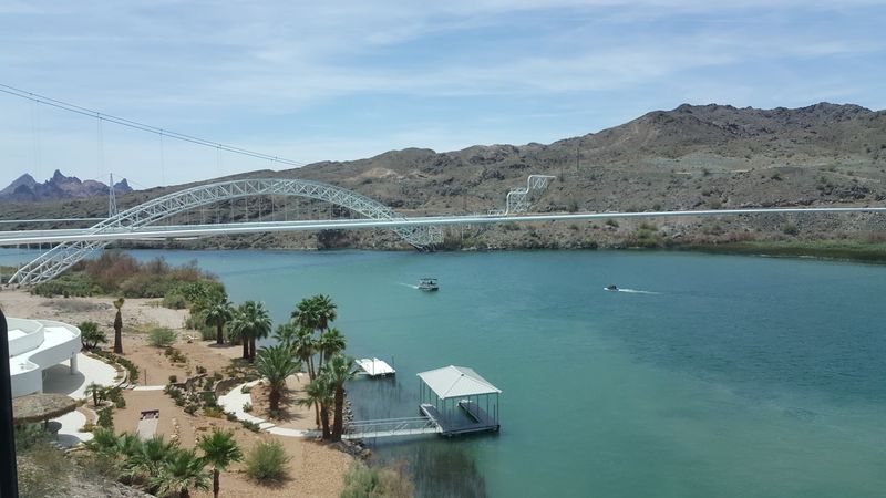
Some places announce themselves with billboards and gift shops. Topock barely clears its throat.
The official address is simply Topock, AZ 86436, in Mohave County, Arizona, in the United States. It is a small unincorporated community and census-designated place on the western edge of the state.
As of the 2020 census, the population within the census-designated place was just two. That number is not a typo, and it tells you plenty about the pace here.
Topock sits along the Colorado River, which forms the border between Arizona and California in this stretch of desert. Needles, California, lies a short drive to the northwest, while Lake Havasu City sits farther south in Arizona.
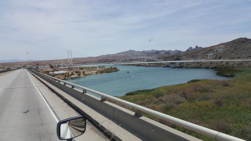
Interstate 40 passes close by, which is exactly why so many Arizonans have zipped past without a second look. The highway crosses the river here, and most drivers are focused on making time rather than making stops.
For locals hunting a getaway that feels far from the usual weekend crowds, that is the appeal. Topock is less a town to tour and more a doorway to the river, the marsh and the canyon country around it.
Small, yes. Forgettable, not even close.
Why the River Shaped Everything
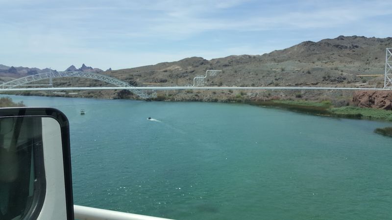
Long before anyone drew a state line, the Colorado River was the main attraction in this part of the desert. Everything about Topock traces back to that water.
The river here is the dividing line between Arizona and California. That makes Topock a natural crossing point, and crossings tend to collect people, roads and stories.
Railroads and highways both found their way to this narrow spot over the years. Bridges went up where the river could be spanned, and a small settlement took root beside them.
Today, the river still sets the agenda. Boating, paddling, fishing and wildlife watching all revolve around the channel and the wetlands connected to it.
The surrounding land is classic Mohave County desert, with rugged hills and wide open stretches. Against that backdrop, the river feels like the reason the whole place exists, because it largely is.
For Arizonans who spend summer chasing water, this stretch of the Colorado offers a lower-key alternative to busier lakeside hubs. There are no big resort strips crowding the banks right at Topock.
That quiet character is part of the draw. The river does the talking, and everyone else mostly just listens.
Old Trails, Old Roads, Old Stories
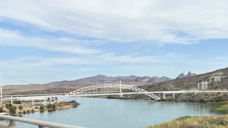
Here is a fun fact for the next road trip trivia round. Topock sits on the route of historic Route 66, one of the most famous roads in American history.
Travelers heading west once crossed the Colorado River near Topock on their way into California. The historic Old Trails Bridge, a steel arch structure, carried that traffic for years.
The bridge dates to the early twentieth century and later became known for carrying a pipeline after road traffic moved to newer crossings. It remains one of the most photographed structures in the area.
Route 66 fans often connect Topock with the winding stretch of the old highway that heads toward Oatman. That section is known for its curves and its sweeping mountain scenery.
For Arizonans who grew up hearing about the Mother Road, this is a chance to stand at one of its key river crossings. It is a piece of state history hiding in plain sight beside the interstate.
No museum ropes, no ticket booth. Just the bridge, the river and a whole lot of road history.
The Gorge Paddlers Keep Talking About
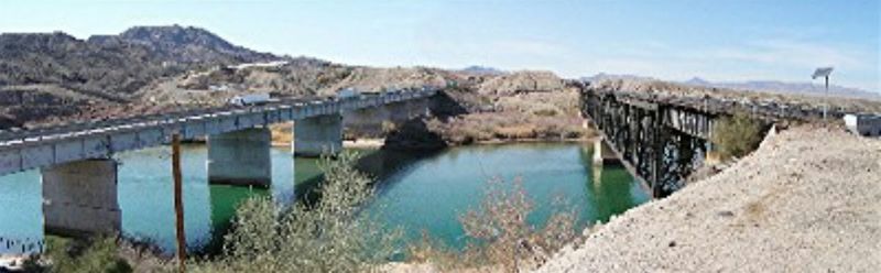
Ask river lovers about this corner of Arizona, and the conversation usually lands on one word. Gorge.
Topock Gorge is a scenic stretch of the Colorado River downstream from Topock. Steep, rugged rock formations rise along the banks as the river winds through the canyon.
Kayakers and canoeists often paddle this section because the river runs through some of the most dramatic scenery in the region. Many trips head south toward Lake Havasu.
Paddling the gorge takes planning. Distances can be long, desert weather can be intense, and conditions on the water change with wind and boat traffic.
Local outfitters in the broader area may offer rentals or shuttles, so it pays to research current options before heading out. Bringing plenty of water and sun protection is a smart move.
Powerboats also travel through parts of the gorge, so paddlers should stay alert. Early starts may help avoid the heat and the busier hours.
For many Arizonans, this is the moment Topock goes from highway exit to bucket list. The canyon has a way of rearranging priorities.
Marshland in the Middle of the Desert
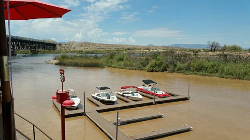
Wetlands are not exactly what most people expect in Mohave County. Topock Marsh happily breaks that expectation.
The marsh is part of the Havasu National Wildlife Refuge, which protects habitat along the Colorado River. It stretches north of Topock toward the Needles area.
Shallow water, reeds and open channels create a home for many bird species. Birdwatchers often visit hoping to spot waterfowl and wading birds, especially during migration seasons.
Fishing and small boat use are also popular in parts of the marsh. Refuge rules apply, so checking current regulations before launching anything is a good idea.
The refuge exists to protect wildlife first. That means some areas may be closed seasonally or limited to certain activities.
For Arizonans who think of their state as all cactus and canyon, the marsh offers a different picture of the desert. It shows how much life the river supports in a dry landscape.
Binoculars are optional but strongly encouraged. The birds are not going to wave you over.
Wildlife Worth a Patient Afternoon
Patience pays off around Topock. The Havasu National Wildlife Refuge was set aside to protect habitat along this stretch of the Colorado River, and the wildlife shows it.
Birds are the headliners. The river corridor serves as an important route for migrating species, and the marsh supports resident birds throughout the year.
Desert bighorn sheep are known to live in the rugged terrain of the refuge. Spotting them takes luck, sharp eyes and some respect for their space.
The best approach is slow and quiet. Early mornings and later afternoons are often more comfortable for both people and animals in the desert heat.
Photographers tend to appreciate the open views and the mix of water and rock. A longer lens helps keep a respectful distance.
Refuge guidelines ask guests to leave wildlife undisturbed and stay within permitted areas. Following those rules helps keep the area healthy for future trips.
Not every outing ends with a dramatic sighting. Still, an afternoon spent scanning the reeds can be its own small reward.
Boats, Ramps and River Time
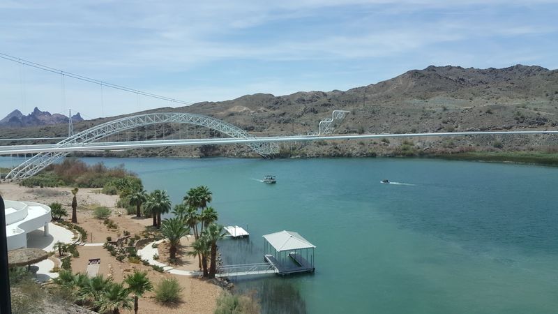
Plenty of Arizonans measure a good weekend in hours spent on the water. Topock gives them a quieter starting line.
The area has served as a launch point for boaters heading into Topock Gorge and down toward Lake Havasu. A marina has operated near the river crossing for years.
Services and hours at marinas can change, so calling ahead or checking online before a trip is wise. That includes fuel availability, launch fees and rentals.
Boating rules on the Colorado River apply, and parts of the river fall within the wildlife refuge. Speed limits and no-wake zones may be posted in sensitive areas.
Summer is busy season for boating across western Arizona. Weekdays may offer a calmer river than holiday weekends.
Families often use the river for relaxed cruising and swimming near shore where it is safe. Life jackets are a must, since river currents can be stronger than they look.
River time here is less about spectacle and more about drifting at your own pace. That might be the whole point.
Fishing Without the Elbow Bumping
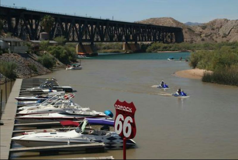
Crowded fishing spots test anyone’s patience. Around Topock, the shoreline tends to offer a little more breathing room.
The Colorado River and Topock Marsh are both known as fishing areas. Anglers commonly target species such as bass and catfish in this part of the river system.
Fishing rules here can get a bit layered. Because the river forms the state line, license requirements for Arizona and California waters may differ.
Checking current regulations from wildlife agencies before casting is the safest move. Refuge areas may also carry their own rules about access and boat use.
Shore fishing, small boats and kayaks all show up in the mix. The marsh in particular appeals to anglers who like quieter water.
Hot summer days push many people toward dawn and dusk sessions. Shade can be limited, so planning around the sun matters.
The fish may or may not cooperate. The low-key setting, however, rarely disappoints.
Gateway to the Oatman Curves
Topock is a fine stop on its own. It also happens to sit near the start of one of Arizona’s most talked-about drives.
Historic Route 66 heads northeast from the Topock area toward Golden Shores and then up into the Black Mountains toward Oatman. The old road climbs with tight curves and wide desert views.
Oatman is a former mining town known for the wild burros that wander its streets. It is a popular detour for Route 66 fans.
The mountain section beyond Oatman includes sharp switchbacks and narrow stretches. Drivers should take it slowly, especially in larger vehicles.
Fuel and services can be spread out in this part of Mohave County. Filling up before leaving the interstate area is a practical choice.
Pairing a morning on the river with an afternoon drive makes for a full day trip. It blends water, history and mountain scenery in one loop.
Just keep both hands on the wheel. The curves earn their reputation honestly.
Who Will Love It Most
Not every destination suits every traveler, and Topock does not pretend otherwise. Its charm comes from what it lacks as much as what it offers.
Outdoor fans are the clearest match. Paddlers, anglers, boaters and birdwatchers all find something worth the drive.
Route 66 enthusiasts will appreciate the history around the river crossing and the nearby road to Oatman. Photographers tend to enjoy the bridges, the gorge and the desert light on the hills.
Arizonans living on a budget may like that so much of the appeal is outdoors. Much of the experience centers on public land and open scenery rather than paid attractions.
People hoping for shopping streets, nightlife or a long list of restaurants should adjust expectations. With a population of two in the census-designated place, Topock is not a bustling town center.
Families with kids who love water and wildlife can have a great day, with good planning. Bring supplies, because services are limited right at Topock.
Know what you are signing up for, and the quiet becomes a feature, not a flaw.
Timing a Trip Around the Heat
Western Arizona does not do mild summers. Timing matters around Topock more than almost anywhere in the state.
Summer temperatures along the lower Colorado River often climb very high. That draws people to the water, but it also makes midday activity tough.
Many locals plan river outings for early mornings during the hottest months. Shade, water and sun protection are essentials, not extras.
Spring and fall can be more comfortable for hiking, wildlife watching and paddling longer distances. Migration seasons may bring more bird activity to the marsh.
Winter days are often milder, which can appeal to Arizonans looking for a calm desert outing. Some boating services may run reduced schedules in cooler months.
Holiday weekends tend to bring more boat traffic to the river system. Midweek trips may help those seeking a quieter experience.
Weather and river conditions can change quickly. A fast check before leaving home goes a long way.
Pick the right window, and Topock rewards you with calm water and open space.
Practical Notes Before You Go
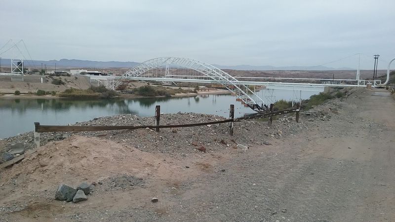
Getting to Topock is the easy part. Interstate 40 runs right through the area near the Colorado River crossing, so most drivers simply follow the highway west across Mohave County.
From the Kingman area, the trip heads west on the interstate toward the California line. Lake Havasu City lies to the south, and Needles, California, sits just across the river to the northwest.
Because Topock is so small, services can be very limited. Fuel, groceries and lodging are more widely available in nearby larger communities.
Hours and fees for marinas, rentals and refuge facilities are not fixed in any single listing. Checking directly with each provider before a trip is the best way to avoid surprises.
Cell service can vary in remote desert and canyon areas. Downloading maps ahead of time is a smart backup.
Pack plenty of water, sun protection and a basic first aid kit. Life jackets are essential for any time on the river.
Planning a little more than usual pays off here. Small places reward prepared guests.
A Small Place With a Long Reach
A census count of two does not sound like much of a destination. Then again, numbers rarely tell the whole story.
Topock packs a surprising amount into its quiet corner of Arizona. There is the Colorado River, the historic Old Trails Bridge, the dramatic Topock Gorge and the wildlife-rich Topock Marsh.
It also connects Arizonans to a famous slice of Route 66 and the winding road toward Oatman. That mix of history and scenery is hard to match in such a small footprint.
It is not a polished resort town, and that is the honest truth. Travelers who arrive expecting busy streets may leave puzzled.
Those who come for river time, open views and a slower pace often find exactly what they wanted. The appeal lies in space, water and stories that predate the interstate.
For locals who think they have seen every corner of their state, Topock is a gentle challenge to that idea. It has been waiting right off the highway this whole time.
Next time I-40 heads west toward the river, consider taking the exit. The quietest stop might become the one you talk about most.