
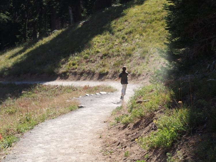
Central Oregon is a gem for outdoor-lovers that gets overlooked by families that flock to the Olympic Peninsula, Oregon Coast, or the larger National Parks. Yet there are so many fun things to do near Bend, Oregon with kids. To Pacific Northwesterners, the outdoor beauty of the Beaver State is no secret, but to those of us here on the East Coast, Central Oregon is surprisingly jam-packed with outdoor adventures.
Whenever moms ask me for a place to take their tweens or teens that love nature and the outdoors, I always point them to Central Oregon. From star gazing to hiking, white water rafting, rock climbing, and even spelunking…your kids will not get bored!
Things to do Near Bend, OR with Kids
Note: Our accommodations and some activities were hosted by the Central Oregon Tourism Association and its partners, all opinions are my own.
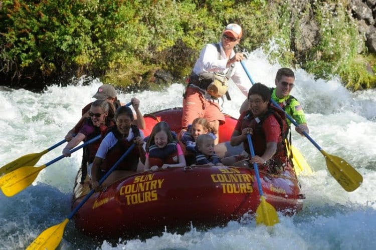
Try White Water Rafting on the Deschutes River
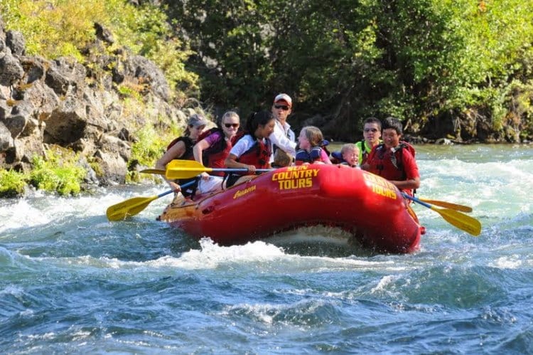
We tried white water rafting for the first time with Sun Country Tours. While I was nervous, my 10-year-old was excited for our ride on the Deschutes River as part of the “Big Eddy Thriller.”
Our guide Matt quickly put my mind at ease by first telling us how to brace ourselves by wedging our feet in the gutter on the inside edge of the boat. This is the most important factor in keeping you in the boat so I listened hard and followed his instructions explicitly. Of course there isn’t anywhere to wedge your feet in the center of the boat but the other kids on our tour, aged seven and nine, decided to kneel up front where they would get the most spray and excitement. My daughter decided to sit or kneel in the middle on the boat and hang on to the strap to keep her inside.
After a brief tutorial on how to paddle as we slowly drifted down the Deschutes, we were ready for our first ride through some white water. That first bit was just a tease for the main event — the Big Eddy — around the bend. We were hoping to have more fun with the gentler rapids before entering in the Big Eddy’s Class 3+ rapids but on this short trip, there was no easing into it. However, before getting into the big water, we pulled off to take a look at the rapids and talk strategy.
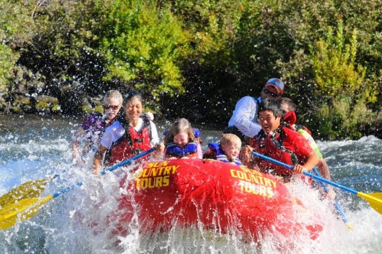
As nervous as I was going into it, everyone else on the boat was completely stoked to go through the Big Eddy. What makes the Big Eddy challenging is that it is a series of three Class 3 rapids, one right after the other. As a paddler, when you are going through these rapids you are so focused on following the directions of the guide to keep you on course and away from the rocks, and using your feet and core to stay in the boat, that you really don’t have time to be nervous any longer. It was absolutely exhilarating!
After the Big Eddy it was easy going from there. We went through one other small set of rapids before slowly drifting down the Deschutes River toward Bend. During this time, my daughter lost all fear and went up front for the smaller rapids and even climbed on the front of the boat with her legs dangling (known as bullriding). Once through the rapids we were invited to jump in and float along the river, something you see many people doing on tubes up in Bend. I stayed in the boat but my daughter jumped in for a while but the water was cold so it wasn’t long before Matt grabbed her by the life jacket and hauled her back in like landing a fish.
The Big Eddy Thriller is not recommended for children under six and kids need to be at least 10 to paddle.
Tips for Rafting the Big Eddy
- Book in advance, especially if you have a big group.
- Wear water shoes or shoes that strap tightly to your feet and dry easily.
- Wear quick drying clothes that are comfortable for rowing and wearing under a life jacket — like exercise clothes, board shorts, rash guard shirts or bathing suits. Wear light layers on cooler days.
- Go to the bathroom before you leave because there are not any facilities during the tour.
- Apply sunscreen and bug spray. You may not think the mosquitoes are out during the day but I was attacked from the minute I stepped off the bus.
- Don’t wear a hat or sunglasses unless you are prepared to lose them. One man on our tour lost his sunglasses on our trip.
- Bring a towel because you will be soaked through. Sun Country suggests that you can bring a change of clothes but logistically, unless you are changing on the bus, there isn’t anywhere to do a quick change.
- Bring water or snacks for the bus.
- Don’t bring a camera because you will not have an opportunity to use it. If you want pictures, you are going to have to purchase Sun Country Tours’ photo package.
- If you want great pictures of your family, sit up front.
Go Rock Climbing at Smith Rock State Park
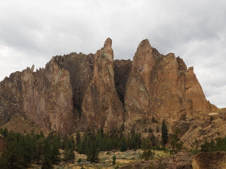
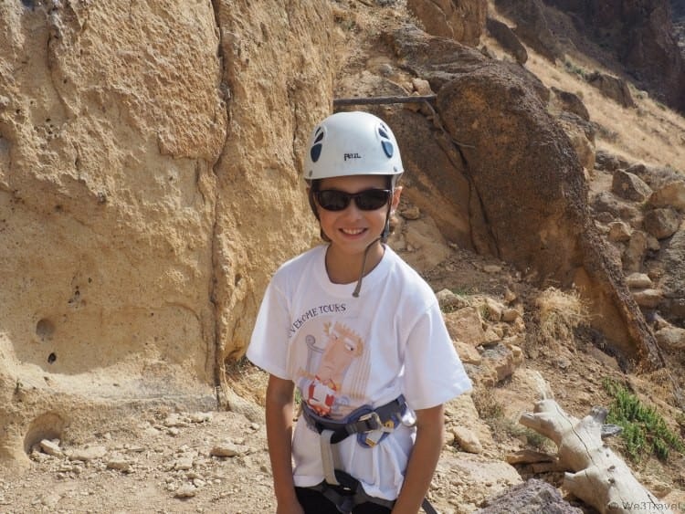
Smith Rock State Park is about 40 minutes north of Bend, Oregon, but when I learned we were that close to one of the best rock climbing spots in the country, I knew I had to make my little rock climber happy and plan a day trip.
She had been taking indoor climbing lessons for years and had just started competing when we visited Oregon. While she had only done a couple of outdoor climbs with her gym, there really is nothing she likes more than climbing on rocks (except maybe eating sushi.)
I wanted to find a reputable outfitter that could provide a safe, instructive, and fun experience for both of us and Smith Rock Climbing Guides came highly recommended. They are AMGA (American Mountain Guides Association) certified and offer a variety of programs and instruction from beginner to experienced. We signed up for a half day (4.5 hours) with a private guide and arranged to meet our guide at the park.
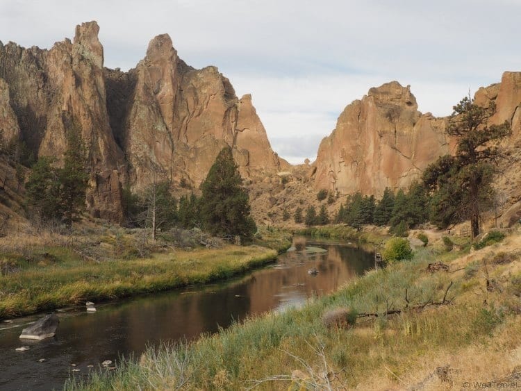
The park itself is absolutely gorgeous and a great place for family hikes as well as rock climbing adventures. Apparently scenes from the Reese Witherspoon movie Wild, based on the best-selling book by Cheryl Strayed, were filmed at Smith Rock State Park.
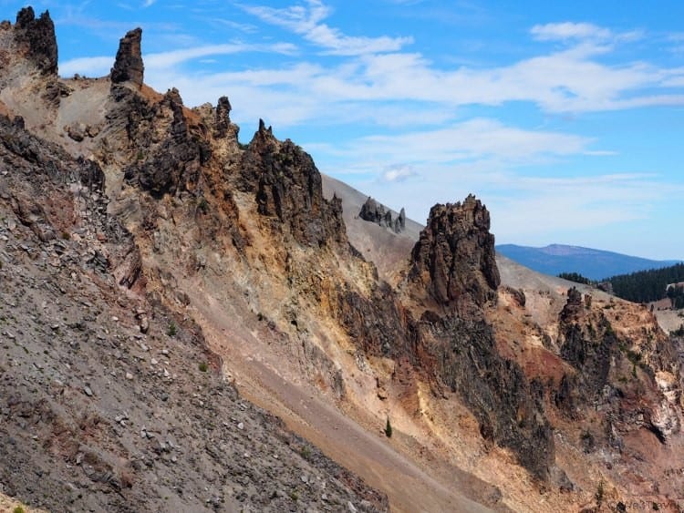
Smith Rock State Park covers over 650 acres and attracts over 500,000 day use visitors annually and has over 1,000 bolted rock climbing routes. Its jagged cliffs were formed from volcanic ash and debris that hardened into rock millions of years ago, forming the Crooked River Caldera. The park became world famous in the mid-1980s as a rock climbing destination, but it also offers several miles of developed trails that provide access to rock climbing areas and offer expansive views of the valley.
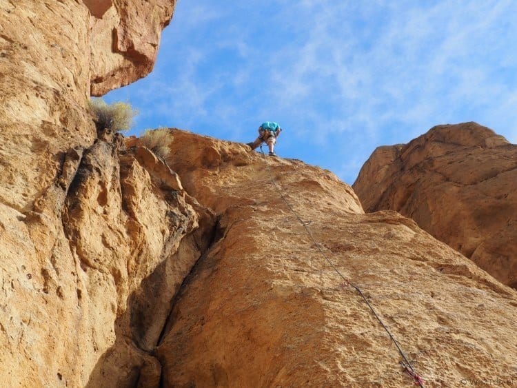
We met Jesse from Smith Rock Climbing Guides in the parking lot, geared up and began our hike into the park. We were headed toward Morning Glory Wall, the site of several beginner climbs (and luckily not up the steep, aptly-named Misery Ridge Trail.) Luckily, we got there early enough that there weren’t a ton of other climbers out yet and we were able to stake a claim near some popular routes.
Since this day was really about her, I let my daughter go first and she pretty easily scampered up the first wall. Maybe her tiny feet and fingers came in handy here because this route was all about gripping the wall with your feet and using small holds to pull yourself up. I made it about two-thirds of the way before my fingers started cramping and my legs started shaking so I had Jesse lower me down. It wasn’t bad, but I knew I could do better. I just needed a confidence boost.
Jesse set our first route, graded a 5.8 in difficulty (about what my daughter climbed indoors.) The difficulty rating is really tough to judge because outdoor is very different than indoor, but also each climb is different. Some may have small holds, other large but require long reach, etc. The best approach is just to try something out and see how you do, then your guide can adjust from there.
Our next climb, rated a 5.7, was much easier for me and I wish we had done it first because then I probably would have tried harder on the first one. It wasn’t graceful, but I made it to the top. I used a crevice in the rock for some easier climbing and then ended up with one arm on either side of a bush and its branches scratching my face. I eventually managed to disentangle myself and scramble to the top, my high point of the day.
With time flying by quickly, I wanted my daughter to get as much climbing in as possible. Plus, I’m a strong believer in going out on top. So I sat back to enjoy the scenery while she geared up for her first 5.9 outdoor climb. And it was huge. Still single pitch (just one top rope, not a series of ropes), but at least 100 feet tall, with large holds but big reaches for her 10 year-old arms and legs. It took a while and I couldn’t believe she stuck with it. My neck was hurting from craning up to watch her and at one point, I could barely see her at all as she crested a curve to reach the top of the climb.
I was so proud of her when she reached the top because I knew this was going to be a huge confidence boost for her. In fact, she still talks about the feeling she had when she was on the wall and how she considered giving up but kept pushing herself to continue. She told me when she got to the top she felt like shouting as loud as she could, she was just so filled with joy and pride at her accomplishment. I hope she remembers this lesson as she continues to become more resilient when she faces life’s challenges.
Tips for Rock Climbing at Smith Rock with Kids
- Find a AMGA certified guide
- Plan to meet early before the park gets too crowded so you can get onto good climbs without waiting
- Bring a backpack large enough to hold your food, drinks, and gear
- Wear hiking boots or sturdy shoes for hiking into the park and scrambling over rocks (your guide can provide climbing shoes, helmets, and harnesses if you don’t have your own.)
- Bring snacks and plenty of water, or a full lunch for a full day outing
- Wear sunscreen and sunglasses, you might also want a hat for when you aren’t climbing to keep the sun off
- Use the toilets by the parking lot before you head into the park — it is a long, steep hike back out
- Wear long pants or close fitting capri length pants as you will bang up against the rock some so expect a few scrapes and bruises
- Watch out for rattlesnakes basking in the sun. We (luckily) didn’t see any. We also saw a warning for a cougar/mountain lion sighting in the more remote part of the park.
Visit Crater Lake National Park
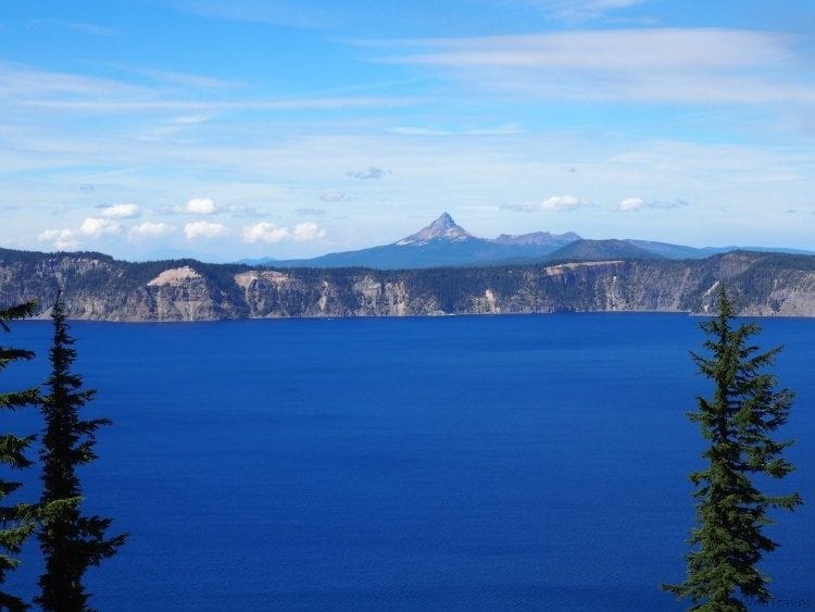
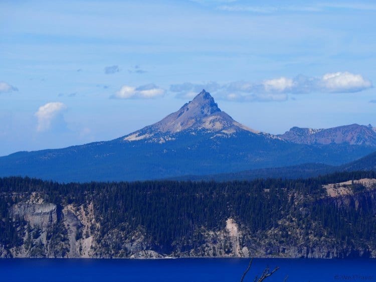
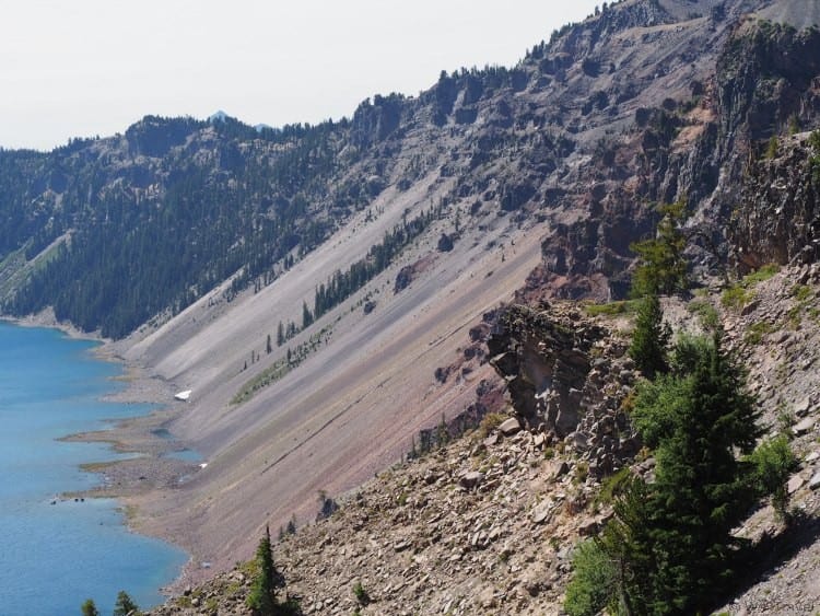
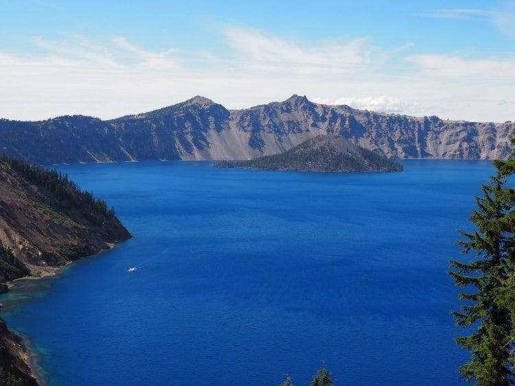
Crater Lake is a must-visit when you are in Central Oregon. Located about two hours south of Bend, you really need to see Crater Lake to fully appreciate it, as even photographs don’t do it justice.
Since we were staying in Sunriver, we approached Crater Lake from North Entrance Road, driving through the Pumice Desert and across the Pacific Crest Trail to reach our first lookout at Merriman Point. We probably spent 30 minutes here just drinking in the view and taking photos from every angle. Our eyes just couldn’t get enough of the expansive, deep blue of Crater lake.
Adventurous hikers can set out along the west rim trail from the North Junction at Merriman Point down to Crater Lake Lodge at the south rim. If you are traveling by car or by bike, you can make a left around the East Rim Drive or go right on the West Rim Drive. If you are planning on taking a boat tour around the lake, you’ll want to head onto the East Rim Drive to Cleetwood Cove Trail, the only place that you can hike down to the water and the site of the boat launch.
We headed onto the West Rim Trail, which was the shorter path to Rim Village at the south rim of the lake, and where we planned to have lunch. If you plan ahead (that would be smart), you can bring a picnic lunch and stop and eat at many points along the way and enjoy the view.
There are no railings along the edge of the caldera so you need to be careful and keep children close at hand. You may see some people hiking out on rocks or other precipices, but the only true path down to the lake’s edge is at Cleetwood Cove Trail.
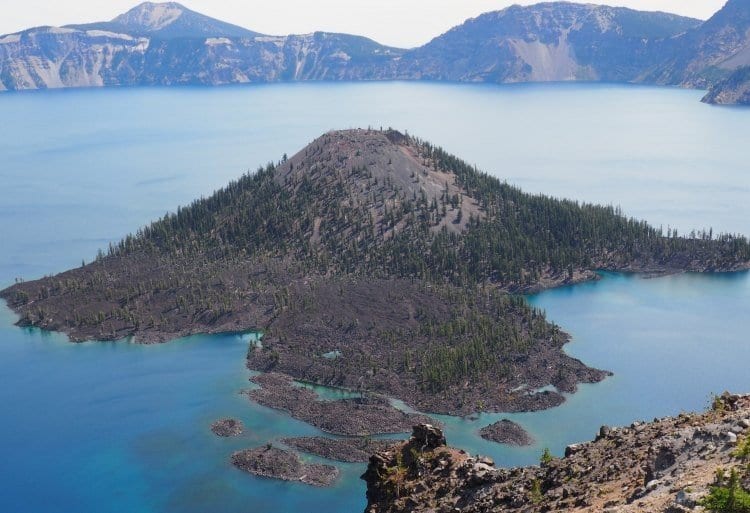
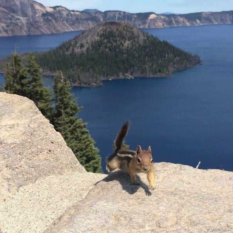
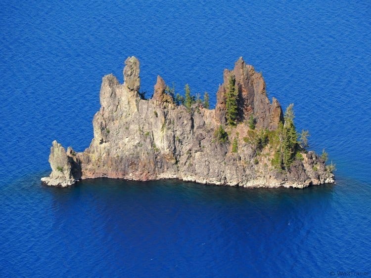
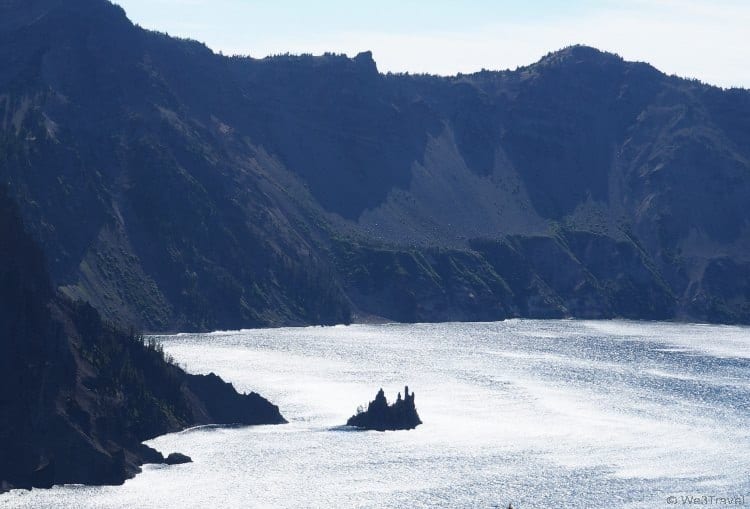
Wizard Island is the most notable site on Crater Lake and you can photograph it from many directions, including a great view at The Watchman and Discovery Point lookouts. There is a boat tour that stops at Wizard Island so people can hike and explore the island.
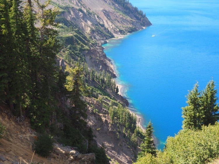
The water around the edge of the West Rim is a gorgeous turquoise blue, looking more like the Caribbean than a lake in Oregon, transitioning through some incredible shades of blue.
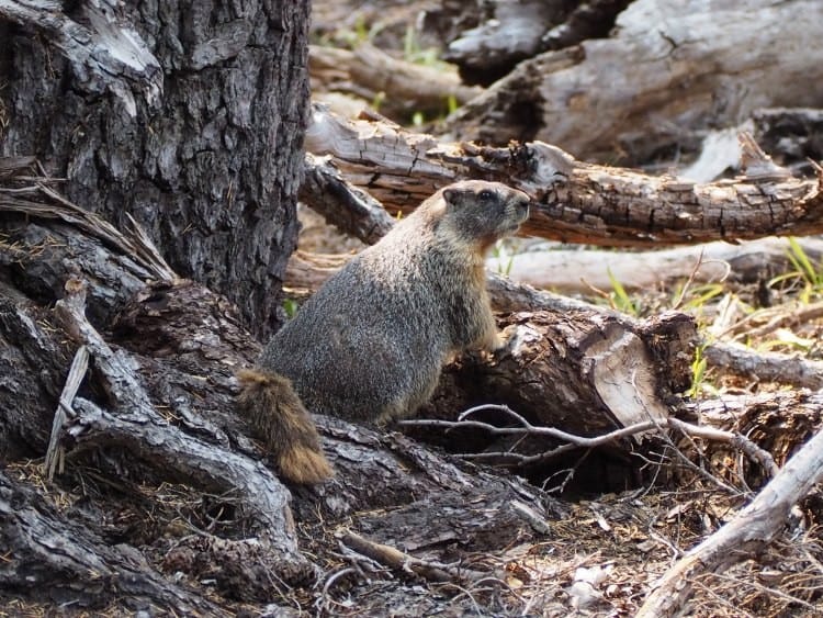
At The Watchman Overlook, you will find some of the wildlife at Crater Lake, including many adorable ground squirrels. You may think they are chipmunks, but as we learned at the Lava Lands, chipmunks have stripes on their faces and ground squirrels do not. Many visitors were feeding these furry guys (against regulations I’m sure) and therefore they have gotten friendly. Maybe a little too friendly. I had to keep my daughter from trying to pet them because I’m fairly sure getting bitten wouldn’t be a good idea.
Crater Lake is just so beautiful from every angle that even when you start to get tired of finding a parking spot and jumping out of the car, you just can’t stop taking photo after photo in an attempt to capture nature’s beauty.
After a quick lunch and bathroom break at the Rim Village Cafe and Gift Shop, we headed south to meet up with East Rim Drive. You wind your way south, past Park Headquarters and toward the Annie Spring Entrance Station and Mazama Village, but hang a left onto East Rim Drive to see the other side of the lake.
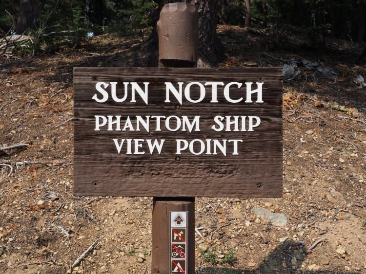
At first you think you are heading away from the lake, as you wrap around mountains, but you will slowly work your way back to the lake and its magnificent views. We stopped at the Sun Notch trailhead to stretch our legs a bit with a short hike out to a great view of the Phantom Ship rock formation.
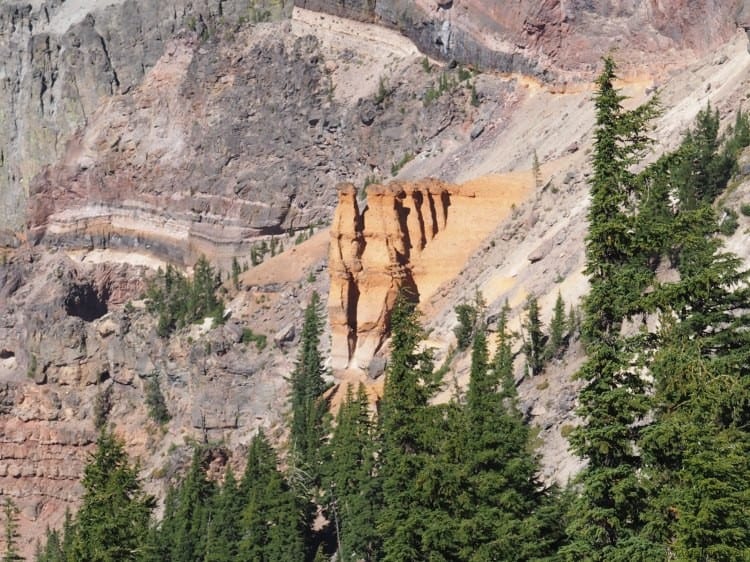
When we stopped for lunch we had heard that the East Rim Drive was closed past Sun Notch until after 5 pm due to construction or repair from falling rock. Luckily, by the time we finished our hike the road was open so we didn’t need to backtrack but could continue on our loop around the lake. Our next overlook gave us a great view of Pumice Castle, narrow towers of reddish stone that looks like the turrets of a castle.
At the end of the day, the light began to fade just a fast as our energy. With only one short hike and a lunch break, we still spent nearly five hours enjoying the many views of the lake. As the sun began to set, the lake water looked glassy and silvery, giving the lake, especially around the Phantom Ship, a bit of an eerie air.
What to Know Before you Go
Crater Lake is located in southern Oregon, formed when a massive volcano left a deep basin in a place where a mountain peak (Mountain Mazama) once stood 7,700 years ago. The lake is big, over 6.02 miles across, and it is also the deepest lake in the United States at nearly 2,000 feet at its greatest depth. The rim towers over the lake at 500 to nearly 2,000 feet above the lake. Crater Lake looks so blue because the other colors of the spectrum are absorbed but blue wavelengths scatter and can be seen by the human eye.
- There is an entrance fee to the park for non-commercial cars.
- The rim drive is 33 miles in total and offers 30+ viewpoints along the drive.
- The only gas station within the park is all the way at the south entrance (Annie Spring) at Mazama Village so make sure you have enough gas when entering the park.
- Food options within the park are very limited, with a small cafe at the Rim Village and down at Mazama Village. It is a smart idea to bring a picnic lunch and make use of some of the picnic tables or scenic lookouts along the drive.
- There are a few non-flush toilet buildings at various lookouts (including Watchman), or large bathroom buildings can be found at the Rim Village.
- There are a number of short hikes that are family friendly and you will receive a pamphlet with a list and description of park trails upon your arrival. Just take a few minutes at the first overlook to review the hike options and see where they are on the map as some (like the Pinnacles Trail) require a decent drive off the main Rim Drive to access the trailhead.
- Hiking or climbing inside the caldera is prohibited. The only access to the lake is on the Cleetwood Cove Trail on the northern part of East Rim Drive. Note that this climb is listed as strenuous with a 11% grade and will take 1.5 hours at 1.1 miles each way.
- It is recommended to make reservations for boat tours in advance. I tried booking a tour a week before our departure for a Friday in August and they were already sold out.
- Don’t expect to be able to upload your photos to Instagram from inside the park because you probably won’t have cell coverage so if you are planning to go separate ways with anyone in your family, make a plan ahead of time.
- Plan on spending at least half a day in the park, or a whole day if you plan on doing many hikes or a boat tour. We spent 4-5 hours and only did one hike.
- If you want to hike down Cleetwood Cove Trail to reach the water’s edge (and even go for a very chilly swim), you might want to start off at on the East Rim. We found that after making nearly a full loop around the lake, we were just too tired to make the hike at the end of the day.
Crawl Through Lava Tube Caves
I’m not sure if it was a good or a bad idea to read Journey to the Center of the Earthjust before exploring lava tube caves on our trip to Central Oregon, but either way, it made it more exciting.
We booked a Lava Tube Cave Tour with Wanderlust Tours and we were excited to discover that we made up half of a group of four, with just our headlamps and awesome guide Danny to lead the way. This tour is completely different from many of the cavern or cave tours you have probably experienced.
To start, our guide Danny ha a background in education and also ran naturalist tours. Combined with his energetic personality, our tour started off strong and continued to educate and entertain even when we were in a big, black tube with nothing around by rock and dust. On the drive out to our caving adventure he told us all about the landscape, the volcano, the history of the area, the plant life and even how the Native Americans used rye grass to create rope.
The landscape around Skeleton Cave
We travelled about 20-30 minutes from Wanderlust’s offices in Bend until we were bumping over dirt roads and then we needed to get out and hike the rest of the way. You see, this wasn’t just any cave tour. We were going to Skeleton Cave, which is only open to commercial tours and Wanderlust is the only tour company with access. That means it is just the five of us and miles of lava tube to explore.
As soon as we approached this gaping hole in the earth we could feel the cool air rushing out at us as if there was something alive down there drawing us in.

The entrance to Skeleton Cave
We descended the ladder, unlocked the gate, strapped on our helmets, flipped on our headlamps and we were off — into the dark — into the center of the earth. Altogether we walked over half a mile into the cave, there really wasn’t a lot to see — no underground lakes, no amazing rock formations. Unlike caverns, this cave was formed by a gushing river of lava that left behind a giant tube and as we were walking through this tube with Danny explaining its history, it was all too easy to imagine a rush of lava coming at us from one of the volcanoes nearby that are long overdue for an eruption.

Danny explaining the cave’s history
After walking through the dust that has accumulated over the years and clambering over a few (not recent) cave ins, we came to a fork in the road. Since we had an adventurous group, we decided to take the road less travelled and get the real cave explorer experience. To do so we needed to climb over some rocks and get down on our hands and knees and then our bellies to venture into new territory.
After climbing over a few more cave ins, spinning around and seeing if we could find our way out, and experimenting with creating sparks in the dark by chewing wintergreen Life Savers (go ahead, you can try this at home in the dark), it was time to head back toward the warmth of the sun.

Climbing through the cave
We had a great time on our tour and enjoyed having a very unique experience. Anyone can go visit the Lava River Cave near Lava Lands off Route 97 if they want a basic cave experience with a large group of people, artificial lighting and paved pathways, but if you really want to feel like an explorer, a tour with Wanderlust is the way to go.
Tips for Exploring the Lava Tube Caves
- Dress warm. It is 45-48 degrees underground and you’ll need some layers like a fleece or a heavy sweatshirt.
- Wear long pants. If you want to go crawling through caves, you are not going to want to do it in shorts, trust me. My knees were hurting even crawling over the rocky ground in yoga pants.
- Wear sturdy shoes. One of our tour members managed in flats but I’d highly recommend hiking boots or sturdy shoes for climbing over rocks. Keep in mind that the floor of the cave is covered in an inch or more of fine dust so whatever you wear is going to get pretty dirty.
- Bring a small backpack with anything you want to bring along — a camera, water, etc. — because you are going to want to keep your hands free.
- Don’t go if you are scared of the dark or get claustrophobic — this tour is not for you!
Learn About the Oregon Trail at the High Desert Museum

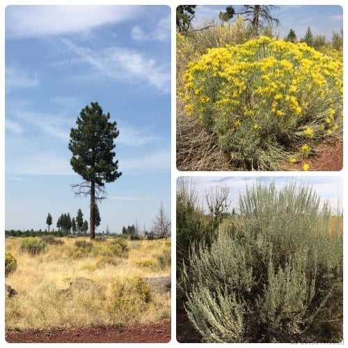
As you leave the Mt. Hood area and enter Central Oregon’s High Desert, you leave behind the towering pines, deep valleys, undulating mountain ridges, and the stark, dramatic rock face of the towering mountain whose shoulders, even in summer, are draped in snow. As the miles roll out along Route 26, the alley of pines through which you are driving give way to scrubby brush, tall brown grasses, red rocks and flat desert buttes. Timber land becomes ranch land, waterfalls give way to hot springs, and you have a hard to believing you are still in Oregon.
It was as I traveled through this landscape that my interest in the High Desert was piqued. It was so unexpected and so contrary to the image I’d been holding in my head of Oregon and the Pacific Northwest that I needed to learn more, and the High Desert Museum was the perfect place to start my re-education.
The High Desert Museum, located just minutes south of Bend, Oregon on Route 97, is situated on 135 acres and offers over 100,000 square feet of exhibit space. This is not your average drive by tourist attraction that you drag the kids to for some obligatory “learning” in the midst of a fun-filled family vacation. On the contrary, this beautifully done museum is well-worth a half day visit if you are anywhere in the Central Oregon area.

When you enter the grounds it feels more like you are pulling up to a luxurious lodge than a museum. While the museum has been serving families since 1982, its gleaming wood and natural stone look as if it was renovated just last week. Clearly a lot of time, thought, and money has been put into making this museum a true reflection of the area.
Inside you will find the main exhibit areas. We started our journey in the “Spirit of the West,” where we followed the path of early settlers that crossed the High Desert (also known at the Great Basin) on the Oregon Trail, mined for gold, and started towns. The very detailed dioramas that depict this trail are accompanied by living history actors that helped us understand what life was like in Oregon in the 1800s. My little Minecraft fiend loved the real life mine cart in the gold mine exhibit. I was very taken with the attention to detail that was given to the creation of the town, complete with a dry goods store, saddlery, and Wells Fargo bank.

Example of life along the Oregon Trail

Mining for gold in the high desert
Next we were able to press our noses against the glass and oooo and aaaahh over the Canadian Lynx, which had been rescued from near starvation after being left in the wild after being raised domesticated. It was quite a surprise to see the lynx and his fellow small cat the bobcat in the museum and it was fun to see the mix of living and still-life exhibits.

We were able to participate in one of the museum’s many daily wildlife presentations and learn much more about small and big cats and I finally learned the difference between a cougar and a mountain lion (quick answer: they are one and the same.)

Is it a cougar or mountain lion? Same difference.
Another wing of the museum told the story of the native people to this area, showcasing the various Native American tribes, their dwellings, beautiful beaded handicrafts, traditional attire, and celebration rituals.

Dwelling of the Plateau Native Americans
Once you are done inside, you still have so much more to see outside. We set off through the beautiful, shaded walking trails to find the Autzen Otter Exhibit. As natural looking as any otter exhibit I’ve seen, we were sad to find the otters curled up in their den sleeping instead of playfully swimming in their habitat.

The otters may have been sleeping but the living history interpreters at the 1904 Miller Family Ranch and Sawmill were very much awake and eager to chat with us. These “local homesteaders” were able to tell us not only about life in the High Desert over a hundred years ago, but also explain the climate variations in the regions and how that impacts the landscape. We took a look at the horses in the barn but didn’t have time to explore the sawmill or the other outdoor exhibits, like the Bird of Prey Center.
The Living History Barn and horses
Explore Lava Fields
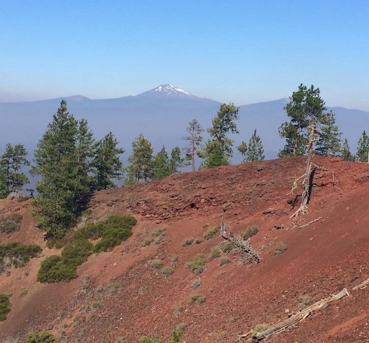
When we went to the Big Island of Hawai’i, we expected to see lava fields (and boy did we!) But in Oregon? I thought Oregon was the land of pine forests or even the high desert? I wasn’t expecting to see lava fields but there I was, driving down Hwy. 97 south of Bend, OR, on our way to Sunriver and on the right I see a towering pile of red rocks, creating a tall butte in the middle of a expansive field of barren land, covered in rough, reddish-black rocks — part of the Newberry Volcanic National Monument.
It is good to know that you don’t need to fly to Hawaii to see the direct impact that volcanic eruptions have had on the landscape. The Lava Lands Visitor Center is a wealth of information and hands on learning about how volcanoes work and the history of volcanic activity in the Pacific Northwest.
The Lava Lands Visitor Center is part of the Newberry Volcanic National Monument, located within the boundaries of the Deschutes River in Central Oregon, covering more than 50,000 acres of lava flows and lakes. In fact, lava flows cover about 1,200 square miles, which is almost the size of our home state of Rhode Island!
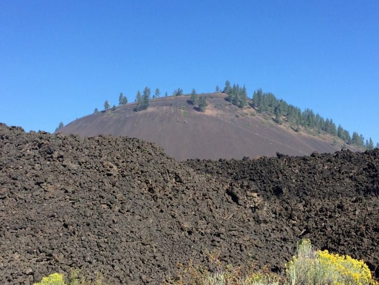
Newberry Volcano is a shield-shaped, “composite” volcano formed by diverse styles of eruption and over 400 volcanic vents. The Newberry volcano eruptions were extremely explosive, with very liquid lava flows, similar to that which we saw in Hawaii. Its volcanic ash can be found as far away as San Francisco. Between the last Ice Age and about 7,700 years ago, the volcano erupted at least a dozen times. Seven thousand years ago, the 500-foot Lava Butte erupted, creating the lava flow we see today at the Lava Lands Visitor Center.
During peak season from June 17 through Labor Day weekend, there is a shuttle that runs approximately every 20 minutes that departs from Lava Lands Visitor Center to access the summit of Lava Butte.
As you gaze across the lava flow, you will see the point where the lava lands turn to forest. This is where the Deschutes River cuts through the land. The volcanic eruption was so powerful that it rerouted the Deschutes River and actually pushed it to begin flowing north toward Bend. You can walk along a gravel path that loops around the entire cinder cone for 360 degree views, with the lava fields on one side and the Deschutes forest on the other. The Butte is 500 feet tall so it was good my husband (who is scared of heights) wasn’t with us on this trip, but we did have some fun teasing him with photos at the edge (but no worries, we weren’t too close.)
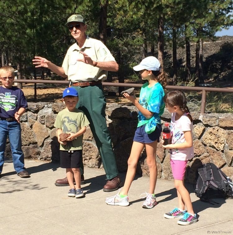
Once you are done hiking around the Lava Butte, you’ll want to leave plenty of time to explore the rest of the Lava Lands Visitor Center. In the main building, you will find an exhibits room and book store, as well as public restrooms. Forest Rangers are on hand to walk you through a three-dimensional map of the Newberry Volcanic National Monument and explain the history of the area.
The exhibit hall showcases local geology, ecology, climate and culture, as well as hands-on activities to explore the bottom of Paulina Lake, understand the physical characteristics of local rocks, and examine a molar of a Columbian Mammoth. We were also lucky when we visited to arrive just before the beginning of a presentation from a Forest Ranger. Our guide was funny and entertaining, packing a lot of learning about the forest, animals, rocks, and of course the volcano, in just a short presentation.
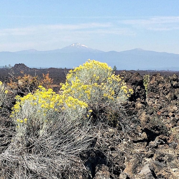
There are also two trails to explore at Lava Lands Visitor Center. You can take a short stroll through the sparse forest area near the lava flow on the Trail of the Whispering Pines, or head out into the lava on the Trail of the Molten Land. The Trail of the Molten Land extends approximately one mile from the visitor center to the base of the Lava Butte. One third of the trail has been newly reconstructed to be universally accessible, making it doable for those with strollers or wheelchairs. The remainder contains some steep grades and can be a bit more challenging if you aren’t physically fit.
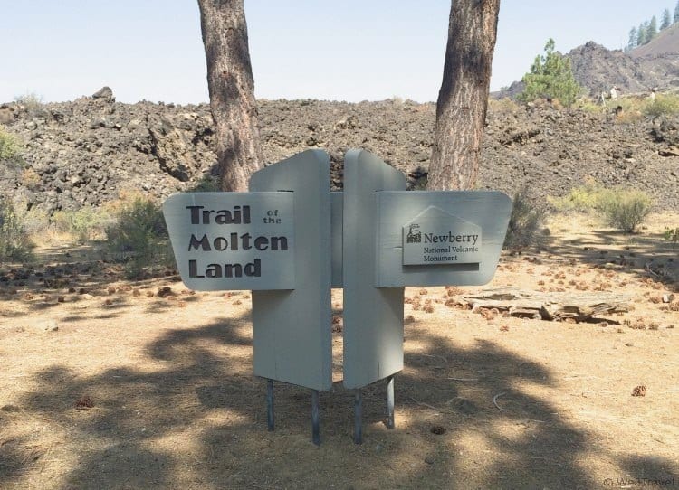
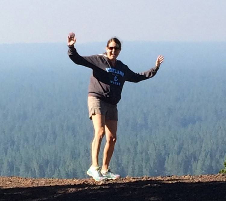
We explored both trails, but we were able to join our Forest Ranger on a guided hike out onto the Trail of the Molten Land, so we got some very good insight into the history, the nature of the explosion and lava flow, and the landscape surrounding the area. Once out at the end of the trail, there were some magnificent views of the Lava Lands. It was exciting to not just see the rough lava fields from above or learn about it at the visitor center, but to actually get out there in the center of it and see the scale of the explosion and touch the rocks that have been there for 7,000 years.

Along the way we learned that NASA used Lava Lands to train its astronauts and test its equipment before landing on the moon. The theory at the time was that the landscape on the moon would be similar. Turns out they were wrong but still a pretty cool fact that inspired my daughter to consider switching her goal of becoming an astrophysicist to becoming an astrogeologist so she could study the rocks found in space.
Once you’ve finished exploring the Lava Lands Visitor Center, you can also tour the nearby Lava River Cave or spend a day enjoying the outdoor pleasures of Paulina Lake or East Lake. We decided to hike to Benham Falls instead.
Tips for Exploring Lava Lands
- There is a fee per vehicle for accessing the Lava Lands Visitor Center.
- Go early in the day to avoid crowds and the hottest part of the day.
- Call ahead to see if there are any Forest Ranger programs scheduled for the day and time your visit accordingly.
- Wear sturdy, closed toe shoes. Most of the trails are paved or flat but the rocks around are rough and dusty and there is a lot of loose gravel at the top of the cinder cone.
- Bring water for everyone, especially if you plan on hiking/walking on some of the Trail of Molten Land as there isn’t any shade and the rock reflects heat.
- Wear sunscreen and a hat to stay protected from the sun.
- There are plenty of parking spots in the main parking lot and flush toilets at the visitor center.
- Lava Lands is closed from mid-October through May, and hours change depending on the season so check the website for more information.
- There is a lot to see so if you plan on taking the mile hike out into the lava flow (I highly recommend it!), plan on alloting about 1.5-2 hours for your visit.
Getting to Central Oregon
The closest airport is Redmond Municipal Airport (RDM), located just a 20-minute drive from downtown Bend.However, you might find more affordable flights into Portland International Airport (PDX), which is a scenic 3.5 hour drive away. If you’re road-tripping, Bend sits directly off US Route 97, the major north-south artery through Oregon.
Where to Stay in Central Oregon
You can stay in downtown Bend, but if you are spending quite a few days in the area and visiting with your family, I’d recommend staying in Sunriver instead.
Sunriver is a planned resort and residential community located 15 miles south of Bend in Central Oregon, just east of the Deschutes River and at the foot of Mt. Bachelor. Spread over 3,300 acres, Sunriver is home to over 4,000 privately-owned residences, 35 miles of bike paths, swimming pools, tennis and pickleball courts, an observatory, Riding Stables, recreation center, and expansive Cove Aquatic Center.
There are many types of accommodations to be found in Sunriver, from guest rooms at the Sunriver Lodge, to luxury homes at Crosswater, luxury cabins at Caldera Springs, and a wide variety of homes, cabins and condos from Sunriver Vacation Rentals.

We were fortunate to be hosted in a spacious and comfortable vacation home at 12 Otter Lane. Conveniently located steps from the water park and just a short drive or bike ride to the Sunriver Village, it was ideal for discovering the best that Sunriver and Central Oregon has to offer.
Equipped with free WiFi, a fireplace, washer and dryer, dishwasher, microwave, full kitchen, 2 full baths, 2 bedrooms, bikes in the garage and even a hot tub on the deck — our Sunriver vacation rental had everything we needed to feel comfortable for our four days in Central Oregon.
Family room, dining area and kitchen

Our very own hot tub
Our Sunriver vacation rental slept six. The bedroom downstairs featured a double bed and bunk beds, with a bathroom across the hall. Above the family room was a sleeping loft with a queen bed and its own full bath and sitting area — offering more than enough space for the two of us.

Bedrooms and lower bath
We loved taking walks or bike rides along the beautiful, peaceful trails throughout Sunriver. Every day we saw wildlife, especially deer, just off the road and even in the island in the center of the traffic circle at the entrance to Sunriver. The Village had the air of a ski lodge, with architecture featuring plenty of wood and stone, and had a warm, communal atmosphere.
Whether it was the music playing through the loudspeakers or the families gathered on benches it was a fun place to hang out on the cool summer evenings. Sunriver offered family movies every couple of days and we were disappointed we arrived too late to see Frozen, but even better on another night we visited the Sunriver Observatory at night for a close up of the amazing night sky.
Perfect for outdoorsy families, Discover Sunriver Vacation Rentals is a place where you can leave your cares and busy life behind and enjoy nature and quality time together. Our only regret was that we didn’t have more time to discover even more of the bounty Sunriver has to offer.

Tamara Gruber is the Founder and Publisher of We3Travel. A former marketing executive and travel advisor, Tamara is an award-winning travel writer and recognized expert in family travel. Tamara is a member of SATW, NATJA, IFWTWA, and the Adventure Travel Trade Association, and serves on the Board of the Family Travel Association. She is also the publisher of YourTimetoFly.com and the co-host of the Vacation Mavens travel podcast.

