
Affiliate disclosure: As an Amazon Associate I earn from qualifying purchases. Learn more
Nine miles of bumpy dirt road and a mile and a half on foot stand between you and one of the most important crossroads in Arizona history. At the end waits a mountain pass where wagon trains, soldiers and Apache leaders once crossed paths, and where crumbling adobe walls still mark the spot.
Along the way you will pass an old cemetery, stone foundations, trail markers every quarter mile and a hillside overlook that puts the whole story in one frame. Keep reading to learn the history, the hike, the hours and the smart tricks that make this free southern Arizona outing worth the dust on your tires.
A Fort Hidden In Apache Pass
Southern Arizona keeps some of its best stories tucked behind the hills, and this one hides especially well.
Fort Bowie National Historic Site sits at 3500 S Apache Pass Rd, Bowie, AZ 85605, in the southeastern corner of the state. It is managed by the National Park Service and protects the remains of a frontier military post set inside Apache Pass.
Plenty of Arizonans have driven past the exit near the town of Bowie for years without knowing what lies a few miles south. The site is not a reconstructed theme park with costumed actors.
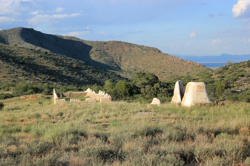
It is the real thing, left in the ground where it stood, with adobe ruins, stone foundations and an old cemetery spread across the hills.
Getting to the heart of it takes some effort, and that is part of the design. The park encourages people to hike in from the trailhead so they can pick up the history piece by piece along the trail.
The location also pairs nicely with a bigger trip, since the site is close to Chiricahua National Monument. That makes it an easy add-on for anyone already headed to that corner of Cochise County.
Fans of national park passport books will want to bring theirs, because a stamp is part of the reward here. Before the stamp, though, comes the story.
Why Soldiers Guarded This Pass
Geography made this spot matter long before any fort went up.
Apache Pass was an important passageway for many people moving across the region. Travelers, soldiers and the Chiricahua Apache all had reasons to pass through, which turned the narrow route into contested ground.
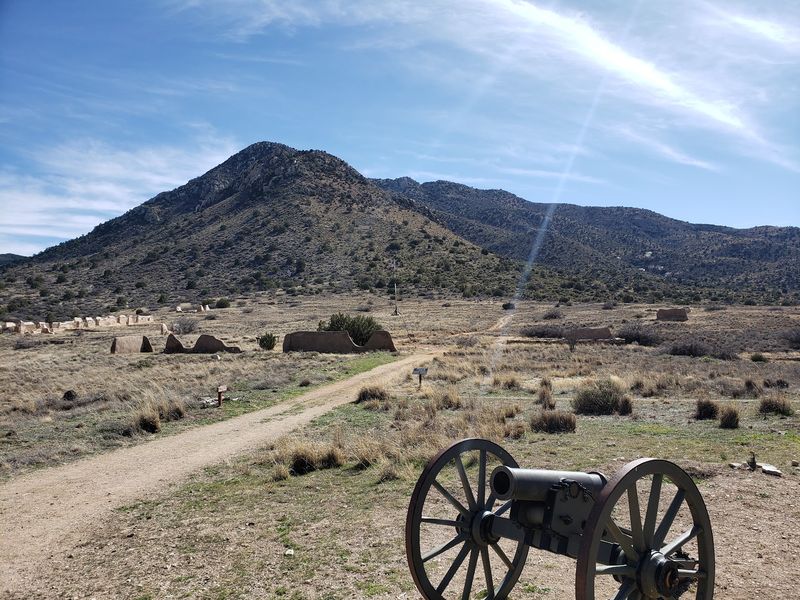
The trail signs do a strong job of explaining why the location was so valuable. Once you see how the hills funnel movement through the pass, the decision to station troops here makes a lot of sense.
Tension in the area grew sharply after a second lieutenant accused Chief Cochise of kidnapping a young boy. That accusation is widely tied to the start of years of conflict between the U.S.
Army and the Apache.
The pass was also the scene of the Battle of Apache Pass, fought between Apache forces and the California Column. Soldiers later established the fort to control the route and the springs nearby.
The exhibits and kiosks cover the people, the struggles and the battles of the area without turning the story into a simple tale of heroes and villains. It is history with real weight, and the trail lets you take it in at your own pace.
By the time the first ruins appear, the landscape already feels like a chapter you have started reading.
Nine Miles Of Dirt Road
Consider the drive in a warm-up act with a few potholes for drama.
The approach involves roughly nine miles of dirt and gravel road, and the roads coming in are not all paved. Some stretches can be bumpy, and drivers in lower cars sometimes worry about their vehicles on the long rumble in.
The good news is that four-wheel drive is generally not required. A small SUV handles the road without much trouble, and slow, steady driving goes a long way.
Patience pays off on arrival, because there is ample parking at the trailhead lot. From there, the real adventure switches from tires to boots.
A few practical moves make the drive smoother:
Check weather before heading out, since dirt roads can change after storms. Fill up on gas and snacks beforehand, as the site sits a fair distance from services.
Leave extra time so the bumpy stretches do not feel rushed.
The remote road is also one reason the site stays so quiet. On many days, only a handful of people make the trip, which means you may have long stretches of trail almost to yourself.
Call it the price of admission, since the actual entry is free.
The Mile And A Half That Tells A Story
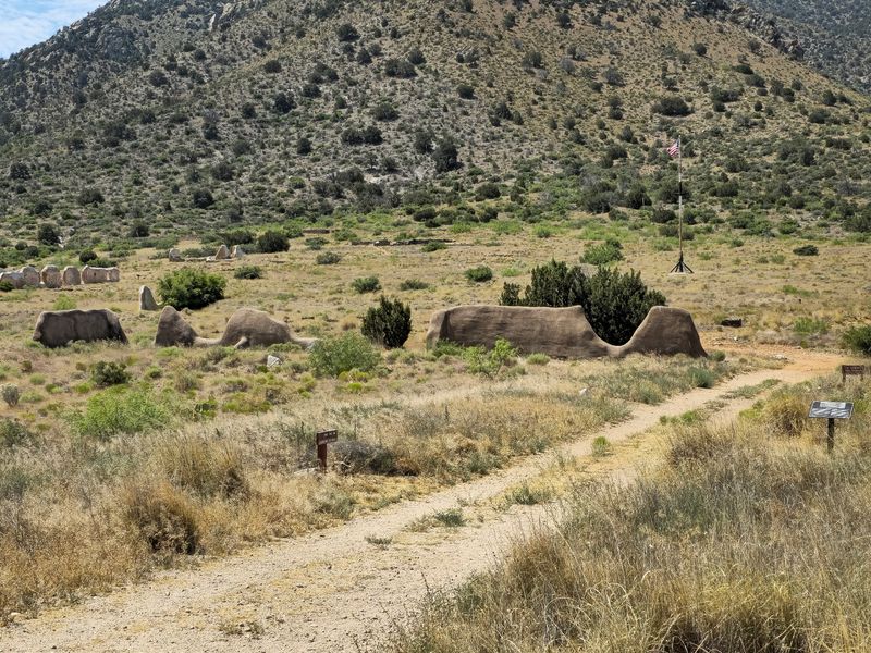
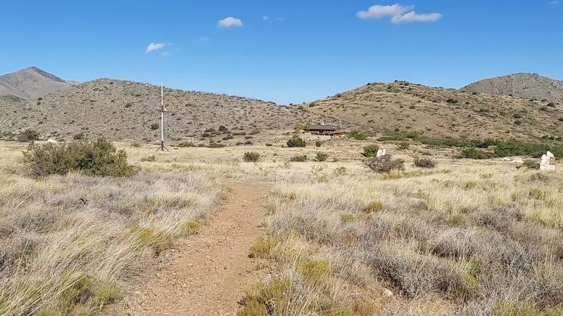
Quarter-mile markers line the main trail, so nobody has to guess how much farther the fort is.
The hike from the parking lot to the fort ruins and visitor center runs about 1.5 miles each way. Signs call it gentle, though the gravel, dirt and rocks push it closer to moderate in spots, and some sections can be slick.
Elevation adds a twist. The trail sits around 5,000 feet, so even fit hikers may find themselves a little winded on the climbs.
Most people cover the distance in about 45 minutes with stops for photos and reading. The path crosses hills, small valleys and washes, which keeps it from feeling repetitive.
Points of interest pop up along the way, each with a plaque or kiosk explaining what you are looking at. Building ruins, natural features and historical spots are all documented, so the walk works like an outdoor museum.
Hikers of many ages make the trip, including spry folks in their 70s who have been known to pass younger groups on the trail. A walking stick helps on uneven ground.
Budget roughly 1.5 miles in, one to two miles of wandering around the grounds, and 1.5 miles back. Your step counter will be thrilled.
Ruins Along The Trail
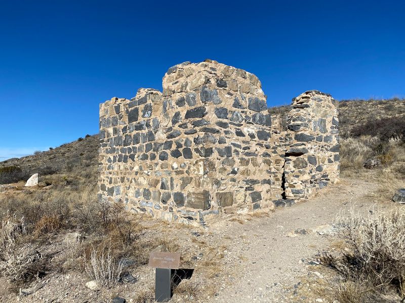
The fort itself is the headliner, but the opening acts deserve attention too.
Quite a few building ruins appear on the walk before you ever reach the main complex. Each one comes with signage that explains its role, which turns every stop into a small lesson.
These stops help set the scene. They show that life in Apache Pass extended well beyond the fort walls, with activity scattered across the area.
History buffs tend to linger here the longest. People who just want a nice hike can keep moving, but even a quick glance at the plaques adds context that pays off later.
Some of the most surprising finds are tiny. Old fragments of glass bottles, pieces of windows, nails and horseshoe nails still rest on the ground in places, remnants that have survived all these years.
Treat them as part of the exhibit. Leaving every piece exactly where it lies keeps the site intact for the next person who comes looking.
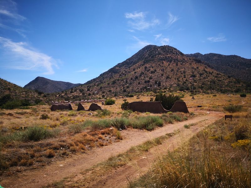
It is worth noting that many of the ruins show only bare outlines of the original structures. Anyone expecting full standing buildings may need to adjust expectations, while anyone curious about how people actually lived will find plenty to piece together.
Think of it as a historical puzzle with most of the edge pieces already in place.
An Old Cemetery On The Way
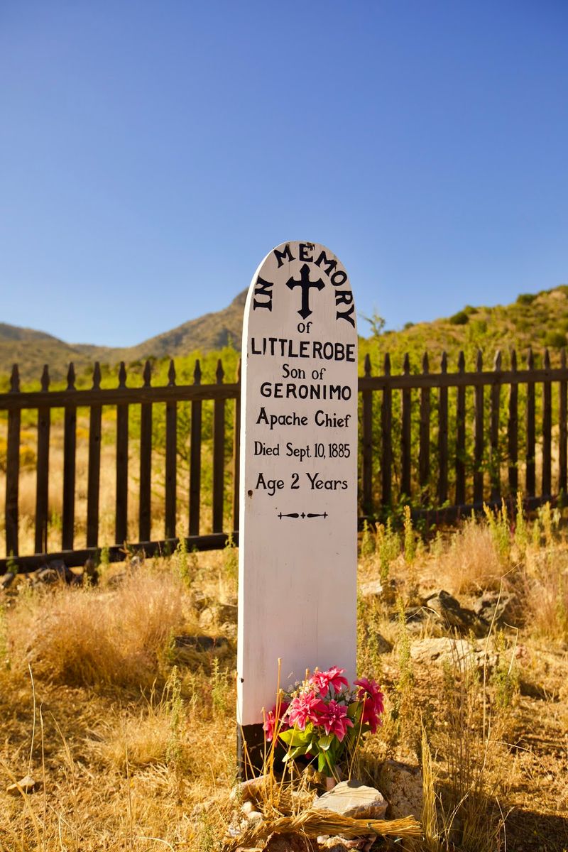
Partway to the fort, the trail passes one of the most memorable stops on the entire route.
The post cemetery sits along the path, offering a quiet pause before the main ruins come into view. It is one of the features people mention most after a trip here.
Simple markers and a fenced area give a personal side to the history. Soldiers, families and others connected to the pass are remembered here, which turns abstract dates into individual stories.
Plaques nearby help explain who is honored and why the cemetery matters to the larger history of the area. Spending a few minutes reading them changes how the rest of the hike feels.
Respectful behavior goes without saying. Stay on the paths, keep voices low and let the place speak through its signs.
For families, it can be a good spot to talk with kids about frontier life in the 1800s. The setting makes those conversations more real than any textbook page.
Photographers often find the cemetery one of the more striking compositions on the trail, with the hills rising behind it. Just keep the visit thoughtful and unhurried.
From here, the fort is not far, and the story picks up speed.
Two Forts, One Pass
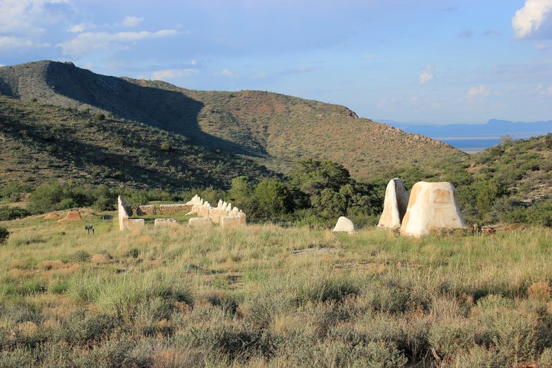
Here is a fun twist many people miss: there is not one Fort Bowie, but two.
Old Fort Bowie and New Fort Bowie both sit within the site, just across from the ranger station. The first ruins you reach mark where the original fort was built, and its foundations are still visible.
The second set is more pronounced and easier to recognize. These ruins line the approach to the visitor center and give a clearer sense of how the later post was laid out.
Many people are surprised by the scale. The fort ruins are much larger than expected, a complex of building remains spread across the slope.
Walking between the two lets you see how the military presence grew over time. It also shows how the layout shifted to fit the terrain of the pass.
Adobe walls, stone foundations and outlines of rooms give enough shape to picture daily routines, from barracks to work areas. The site offers a real sense of what life in the 1800s might have been like here.
The title promises a ghost town jail, and the story behind it is real: prisoners, including men, women and children, were once held at this post. That chapter adds a sobering layer to the ruins.
Spend time here before heading to the visitor center.
A Small Museum With Big Stories
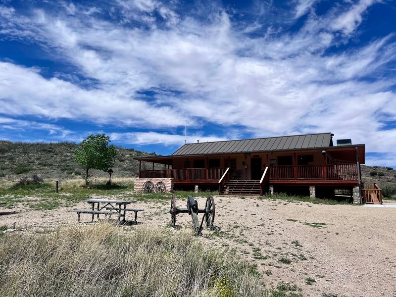
Small does not mean skimpy, and the visitor center proves it.
Inside sits a compact museum with relics found at the fort and displays that pull the whole history together. Many people call it a must-see once they finish exploring the ruins.
A national park gift shop shares the space, and its book selection gets steady praise. It is a great place to pick up a deeper read on the Apache Wars or frontier Arizona.
Rangers and volunteers staff the center, and they have a reputation for being friendly, knowledgeable and genuinely enthusiastic. Ask a question and you may walk away with a story that never made it onto a sign.
Keep an eye out for a friendly ranger dog, a brindle pup who has become a small celebrity with regulars.
Outside, the porch offers a rocking chair and a chance to rest after the hike in. Picnic benches, restrooms and an outdoor water fountain or fill station round out the amenities.
Even on days when the building is closed, the restrooms and water station have remained accessible. That makes the stop useful no matter which day you arrive.
A bugle call also rings out about every 15 minutes, a nice nod to the post’s military past.
The Overlook Trail Back
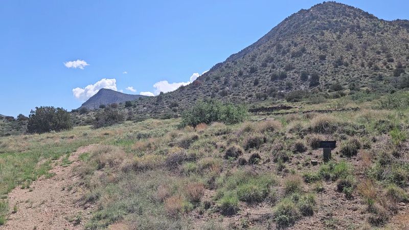
Retracing your steps is easy, but the smarter move is taking the long way home.
A loop option, often called the overlook or scenic trail, heads back to the parking lot by a different route. It climbs a rocky hill before dropping back down to the main path.
Expect a bit more effort. The return is steeper, though easy switchbacks keep the grade manageable for most hikers.
The payoff is perspective. From above, you can see both fort sites and the full building complex laid out together, which helps the whole place make sense.
Many people say this view is what ties the visit together. After walking among the ruins at ground level, seeing them from the hillside shows how the post fit into the pass.
It is easy to forget about the loop after a long morning at the fort. Make a mental note before you start, or you may end up back at the car wishing you had taken it.
Bring enough water for the extra climb. The surrounding Arizona scenery along this stretch is some of the best on the entire route.
Consider it the bonus track that turns a good hike into a great one.
Rocks With Their Own History
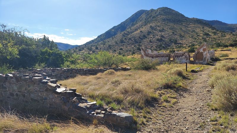
Human history is only half of the story here, because the ground itself has a past.
The site sits on a fault line that has displayed all three kinds of fault movement over time. That includes strike-slip, normal and reverse or thrust faulting, which makes it a quiet treat for geology fans.
Those forces helped shape the hills and the narrow pass that made this route so important. In a way, the geology set the stage for everything that followed.
The site’s geography gives the fort a different character compared with other historic forts in the West. Instead of sitting on open plains, the ruins sit tucked into the hills, shaped by the terrain around them.
Understanding the land helps explain the history. Once you see how the hills crowd the route, it becomes clear why this was such a key location for travel and control.
Families with curious kids can turn the hike into a mini science lesson. Point out the different rock layers and slopes, then connect them to why people needed this pass in the first place.
It is a reminder that Arizona’s backyard holds stories measured in both years and ages.
Junior Rangers And History Lovers
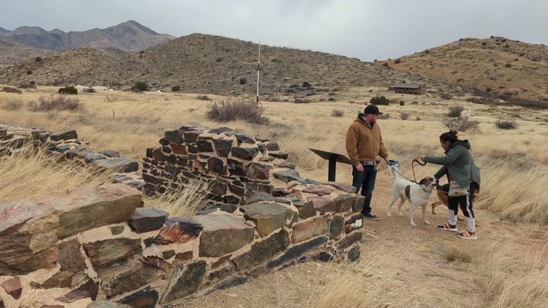
Some places reward a casual stroll, and others reward curiosity. This one leans hard toward curiosity.
History buffs consistently rank the site as a must-see. The mix of trailside signs, ruins, cemetery and museum lets you learn as much or as little as you like.
The Junior Ranger program adds a fun layer, and not just for kids. The activities encourage you to visit all the ruins and think creatively inside the museum, so you notice details that might slip past otherwise.
Ranger-led hikes are another way to go deeper. When available, they bring the stories of the pass to life with context that signs cannot fully capture.
Passport stamp collectors will also feel right at home. Many people find spots like this only after picking up a national park passport book and setting out to fill it.
To be fair, the site is not for everyone. People with little interest in history may find the bare outlines of buildings less exciting than dramatic canyons elsewhere in Arizona.
For anyone who enjoys asking how people lived and why things happened where they did, the trip is time well spent.
Arrive curious and leave with a few new questions.
Hours, Access And What To Pack
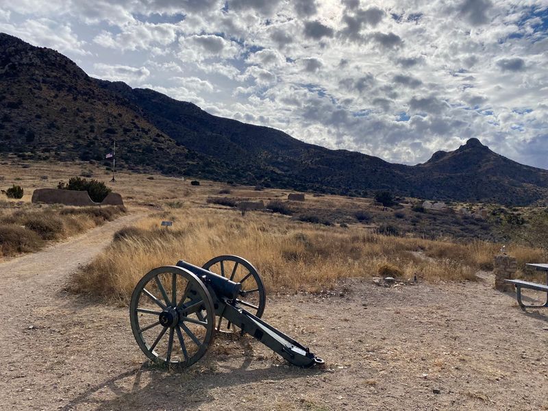
Timing matters more here than at most parks, so check the calendar before you go.
The visitor center is open Friday, Saturday, Sunday and Monday from 8:30 AM to 4 PM. It is closed Tuesday, Wednesday and Thursday, and schedules have shifted in the past, so a quick check of the NPS website before leaving home is smart.
Even when the building is closed, the trails and ruins can still be explored on a self-guided walking tour. You will just miss the museum and gift shop.
Best of all, the site is completely free to enter.
Accessibility is a strong point. A road leads closer to the visitor center for those unable to make the full hike, and calling the visitor center ahead of time helps you learn what accommodations are available.
Packing smart makes a big difference:
Bring extra water, even though refills are available at the ranger station. Add sunscreen, a hat and snacks for the trail.
A walking stick helps on gravel and rocky sections.
Summer days can get very hot, so morning starts are wise. A quiet winter weekday can be a great time to go, with few people and comfortable hiking.
Plan for about two hours for a rewarding visit, longer if you love reading every sign.
A Quiet Corner Worth The Detour
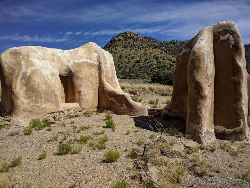
Plenty of Arizona landmarks come with crowds, parking headaches and long lines. This one comes with dirt roads, quiet trails and a free pass to the past.
Fort Bowie earns its strong reputation by being honest about what it is. There are no flashy attractions, just real ruins, a thoughtful cemetery, a small but rich museum and a pass that shaped the history of the Southwest.
The effort is part of the charm. Driving the gravel road, walking the 1.5 miles in and climbing the overlook loop back all help the story sink in.
It is a peaceful, relaxing outing, the kind where you might see only a handful of people all day. That calm makes room for reflection on the soldiers, the Apache and the prisoners whose lives crossed here.
Pair it with Chiricahua National Monument for a full southeastern Arizona weekend. Or make it a standalone day trip when the weekend calendar looks empty.
Either way, it is a spot that many longtime residents still have not seen. That alone makes it a fine bragging right for anyone who claims to know Arizona.
Lace up, fill those water bottles and let Apache Pass tell you its story in person.