Affiliate disclosure: As an Amazon Associate I earn from qualifying purchases. Learn more
Trains once rolled through the suburbs east of the Oakland hills, and today bikes, sneakers, and scooters have taken over their old route. The path is flat, mostly paved, and long enough to fill a whole Saturday.
Riders link town centers, stop for lunch, and roll home without sharing a lane with a single car. Here is everything worth knowing before you clip in, lace up, or buckle a helmet on a small kid.
An Old Railroad Line in the East Bay
Some trails hide in the mountains, but this one runs right through the backyard of the East Bay. The Iron Horse Regional Trail sits in California, USA, stretching through a string of suburban communities east of San Francisco Bay.
The route links Walnut Creek in the north with Dublin and Pleasanton in the south. Along the way it passes through San Ramon and Danville, giving riders a tour of several town centers in one outing.
Officially, it is a sprawling multi-use path with over 30 miles of paved trail. Hikers, cyclists, joggers, and even horseback riders share the corridor.
Most of it is flat, which makes it friendly for almost any fitness level. Riders who want a challenge simply add more miles instead of more hills.
The trail earns a solid 4.5-star average on Google Maps. That is a strong showing for a path that mostly winds behind neighborhoods and shopping centers.
Getting oriented is simple once you know the north and south anchors. The rest of the trip is just a matter of choosing how far to go.
Where Southern Pacific Trains Once Ran
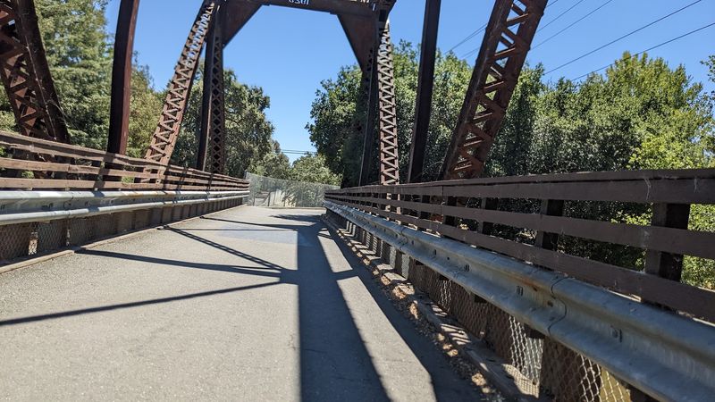
Long before anyone rang a bike bell here, freight and passenger cars rolled down this same corridor. The land once belonged to the Southern Pacific Railway.
That railroad history explains a lot about the trail today. Trains needed gentle grades, so the path stays remarkably level from end to end.
It also explains the straight stretches. Rail lines favored direct routes between towns, and the trail inherits that no-nonsense layout.
The nickname for a locomotive, the iron horse, gave the trail its name. It is a fitting tribute, since actual horses are welcome on the path too.
Those who love a bit of trivia can note that the full corridor has been described as reaching around 40 miles. The paved, popular portion that most people ride runs a little over 30.
No museum or plaques are needed to sense the past here. The shape of the route itself tells the story every time it threads neatly between backyards and boulevards.
Downtown Hopping From Walnut Creek to Pleasanton
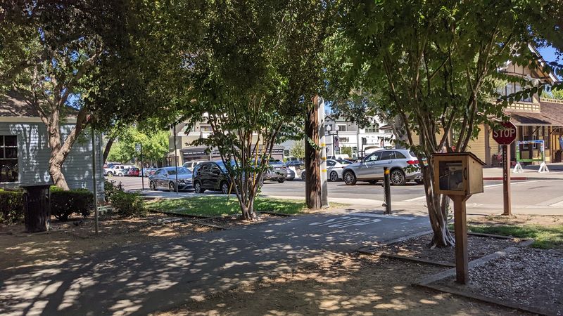
Lunch in one town, a snack in the next, and a ride home before dinner. That is the rhythm many people fall into on this route.
The trail crosses through Walnut Creek, Danville, San Ramon, Dublin, and Pleasanton. Each community gives riders a chance to step off the saddle and explore.
Danville is a favorite pit stop. Cyclists often pause there for a quick bite or a picnic before turning around.
One popular day plan starts at the Dublin end and rides about 12.5 miles north. After a Danville picnic, the return leg makes the total roughly 27 miles.
Walnut Creek finishes differently. The trail there ends with a ride through the city, and it is possible to continue a few more miles to reach the very end.
Because the path is urban, it crosses many roads and passes shopping centers. That makes refueling easier than on a wilderness trail, even if the scenery is more suburban than wild.
Shade, Greenery, and the Prettiest Stretch
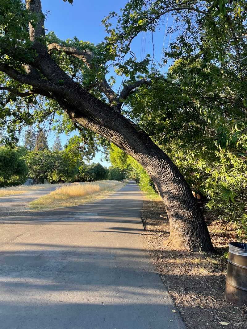
Not every mile looks the same, and that is part of the fun. The trail changes character as it moves north.
The Dublin section near the BART station has little shade. Once the path crosses into San Ramon and Danville, the scenery shifts noticeably.
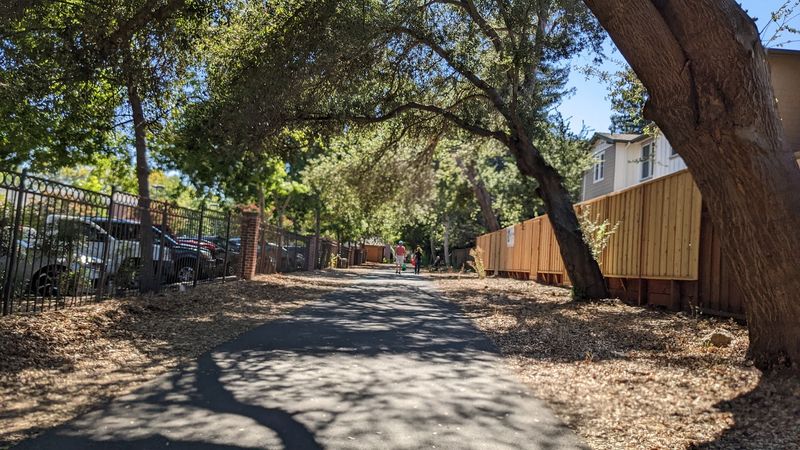
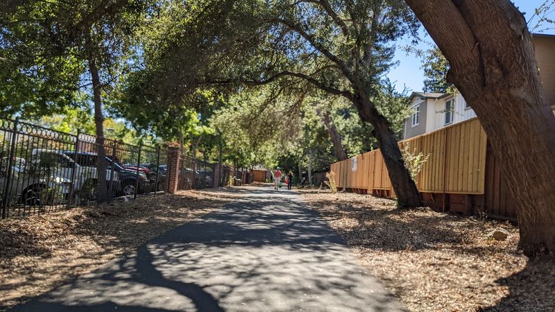
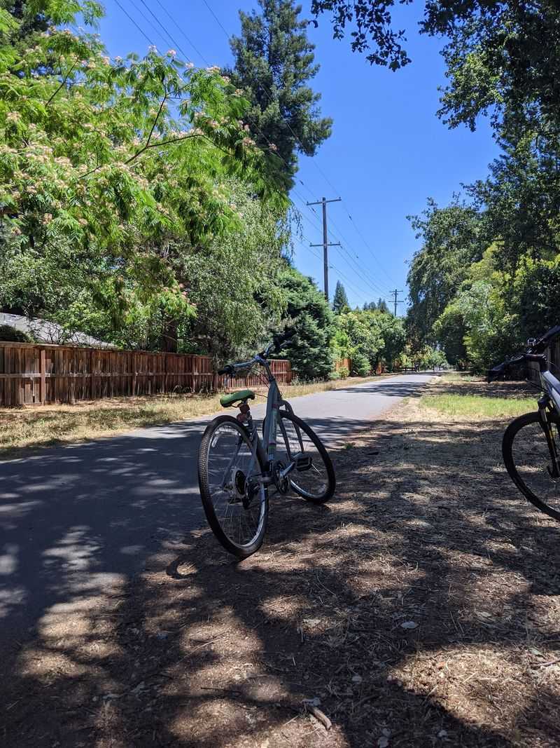
Many riders single out the stretch from San Ramon to Walnut Creek as the best-looking part. Trees line the path and help keep it cooler, even in the summer heat.
Early evenings benefit from those bordering trees too. Walkers find temperatures comfortable as the day winds down.
Wildlife adds another layer of interest. Plenty of animals can be spotted along the way, which keeps kids watching the edges of the path.
Opinions on the views do differ. Some people find long flat sections a bit plain, while others describe the trail as a place of pure serenity.
The honest takeaway is simple. Come for easy miles and green patches, not dramatic mountain vistas.
Room for Strollers, Scooters, and Speedy Commuters
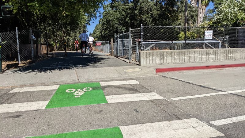
Kids on training wheels and serious runners share this path surprisingly well. The mix of users is one of its defining traits.
Families love it for biking with little kids. The flat grade and car-free lanes take a lot of stress out of a family ride.
Dog walkers, morning joggers, and evening strollers all show up in force. Little ones on scooters are a common sight too.
The path has pavement plus grass along much of its length. That combination suits long walks and runs at almost any pace.
Cyclists especially appreciate riding without cars rushing past. Long stretches without traffic feel freeing on a bike.
The trail is also known as a safe and clean place with easy access. Several people mention how tidy the site stays.
Courtesy matters with so many types of users. A quick call-out or a bell before passing walkers, dogs, or children keeps everyone happy.
Rough Patches, Stop Signs, and Busy Afternoons
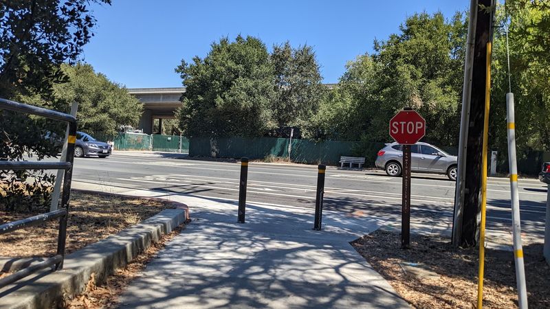
Smooth sailing is the norm, though a few bumps deserve a heads-up. Knowing them in advance makes the ride much easier.
Pavement is rough in some areas. Riders should also watch for parts in Pleasanton along Interstate 680 that are dirt and rock rather than concrete.
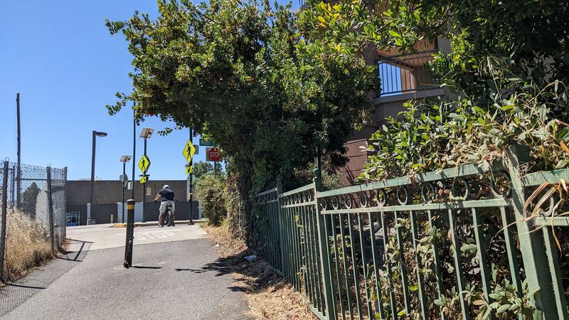
Road crossings come often. Cyclists will meet stop sign after stop sign and need to slow or stop at each one.
Some crossings can be confusing, especially where traffic is heavy. It is not always obvious where the trail picks up again on the other side.
Timing helps too. Afternoons bring lots of walkers, so cyclists who want open space often choose early mornings.
Facilities are limited along certain sections. Restrooms and water fountains are not always easy to find, and shops close to the trail are sparse in spots.
None of these quirks are deal breakers. They simply reward a rider who plans ahead.
Parking, BART Access, and What to Pack
Getting to the start line is half the battle on many trails, but this one connects nicely with public transit. The Dublin/Pleasanton BART station makes a handy launch point.
From the station, exit on the Dublin side and follow Iron Horse Parkway, marked by a green sign across the road. Continue to a T intersection and turn left.
The official trail begins just after a big park on the left. From there it heads north, and signs become more frequent as you go.
Drivers in Walnut Creek have their own options. The Whole Foods parking area and Civic Park are both suggested as good places to leave a car.
Packing smart matters on a long ride. Inland sections get noticeably hotter, so layers, sun protection, and plenty of water are wise choices.
The trail is free to use, so the budget can go toward snacks in town instead. A bell for the bike is also a thoughtful extra.
A Rail Trail Worth the Ride
Speed is optional here, and that is exactly the appeal. One rider covered the full paved route in about an hour, while others turn it into a lazy picnic day.
The trail is not trying to be a wilderness escape. It is an easygoing, car-free link between towns, built on the bones of an old railroad.
Its strengths are clear. Flat grades, long stretches without traffic, kid-friendly riding, and a clean, well-used path all earn steady praise.
Its weak spots are modest. Some rough pavement, frequent road crossings, and few facilities call for a bit of planning.
Locals and nearby hotel guests get the most out of it. Out-of-towners will enjoy it most by pairing the ride with a stop in Danville or a stroll through Walnut Creek.
Pack water, pick a morning start, and choose a town to aim for. The iron horse may be retired, but its old route still has plenty of miles left to give.