
The American wilderness beckons adventurers with breathtaking vistas, but some trails demand more than just sturdy boots and a water bottle. Across the country, certain paths test hikers with death-defying drops, treacherous terrain, and extreme conditions that separate casual walkers from serious mountaineers. For those brave enough to face these challenges, the rewards are equally extraordinary – pristine views few humans ever witness and the profound satisfaction of conquering nature’s most formidable obstacles.
1. Angel’s Landing – Zion National Park’s Sky-High Gamble
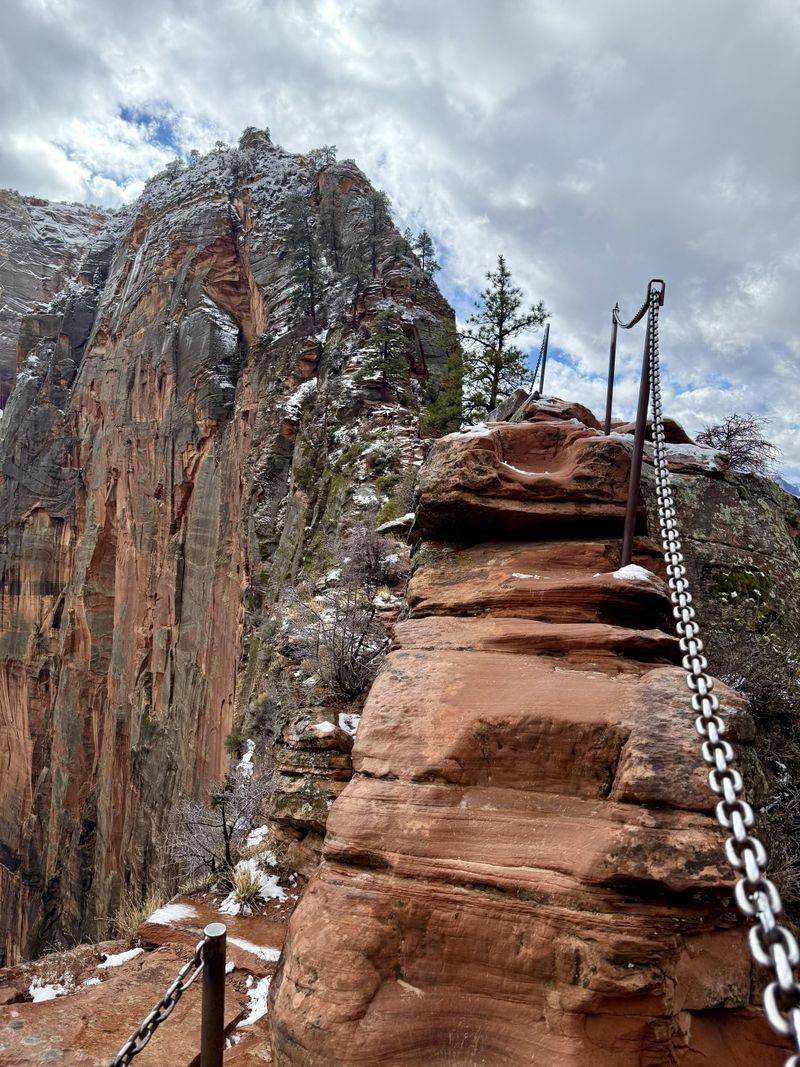
Carved into red sandstone cliffs, this infamous trail challenges hikers with a final half-mile stretch along a narrow spine barely five feet wide in places. Chains bolted into rock provide minimal security as 1,500-foot drop-offs loom on both sides.
Since 2004, at least 15 people have died attempting this trek. The most dangerous sections come after Scout Lookout, where the path narrows dramatically and passing other hikers becomes a nerve-wracking dance.
The park now requires permits to manage crowds, but nothing diminishes the heart-pounding exposure of this legendary trail. Only attempt Angel’s Landing in dry conditions with proper footwear.
2. Half Dome – Yosemite’s Vertical Cable Challenge
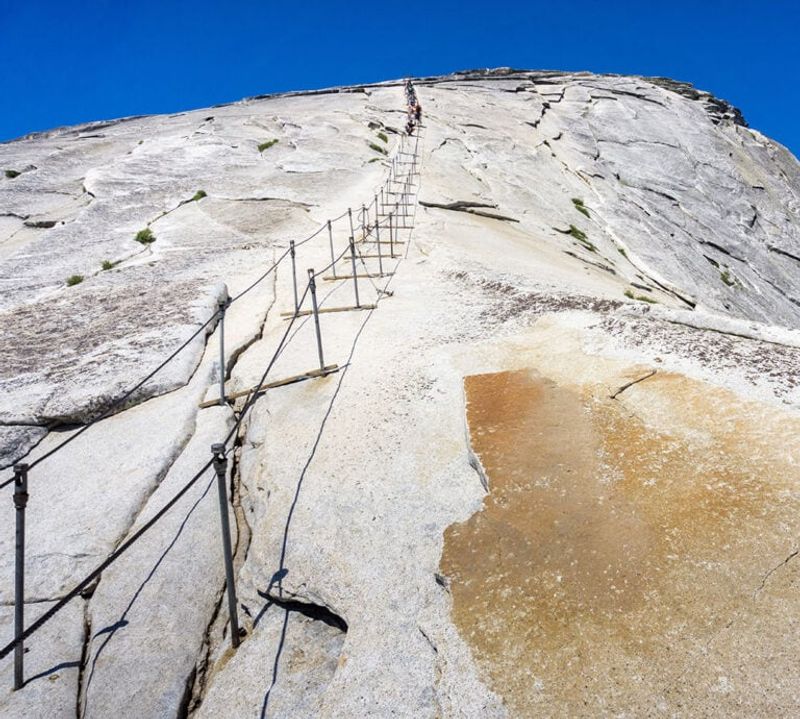
Rising nearly 5,000 feet above Yosemite Valley, Half Dome’s final ascent requires gripping metal cables while climbing 400 feet up a 45-degree granite slope. When wet, this polished rock becomes treacherously slick.
Summer thunderstorms develop quickly here, creating deadly lightning hazards. Several hikers have lost their grip and fallen to their deaths when attempting this climb in poor conditions or with inadequate upper body strength.
The 16-mile round-trip journey demands stamina even before reaching the cables. Rangers recommend starting before dawn and carrying at least 4 liters of water per person.
3. Kalalau Trail – Hawaii’s Slippery Coastal Gauntlet
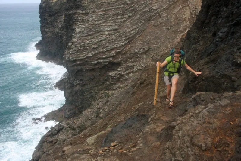
Hugging Kauai’s rugged Nā Pali coastline for 11 miles, this trail combines tropical beauty with serious danger. Narrow sections barely a foot wide cross above vertical drops to the Pacific Ocean below, while frequent rainfall transforms the clay soil into slippery mud.
Crawler’s Ledge, the most notorious segment, forces hikers along an exposed cliff face with nothing but air between them and the crashing waves 700 feet below. Flash floods regularly transform gentle streams into raging torrents that have swept away unprepared hikers.
Despite these hazards, the trail’s remote beaches and lush valleys make it Hawaii’s most sought-after backpacking route.
4. The Maze – Utah’s Labyrinth of Isolation
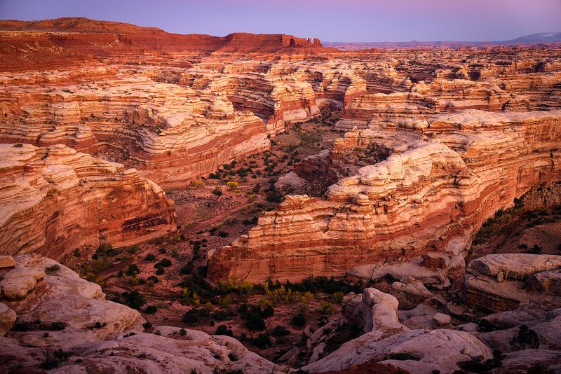
Among America’s most remote hiking destinations, The Maze district of Canyonlands demands self-sufficiency like nowhere else. Rangers openly warn that rescue could take three days to reach you in this complex network of twisting canyons and dead ends.
Summer temperatures regularly exceed 110°F while water sources are scarce and unreliable. Cell service doesn’t exist, and the unmarked routes require advanced navigation skills with topographic maps and GPS.
Even park rangers get lost here occasionally. Edward Abbey described this landscape as “the most terrible place on Earth” – yet those who brave its challenges discover a pristine wilderness few humans ever experience.
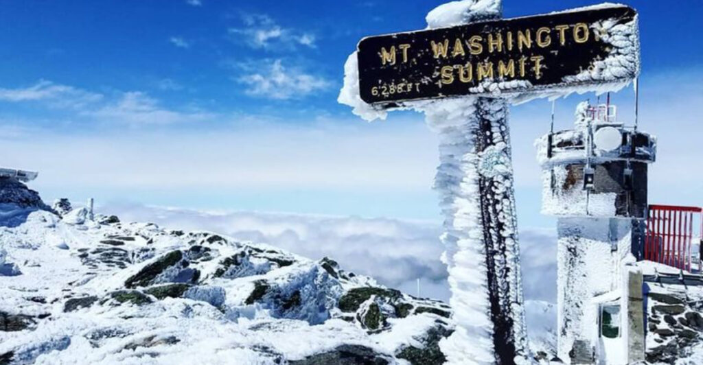
5. Mount Washington – New England’s Weather Monster
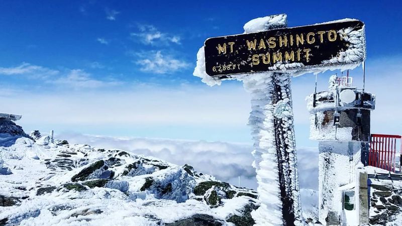
Don’t let its modest 6,288-foot elevation fool you. Mount Washington holds the record for the highest wind speed ever recorded on Earth (231 mph) and creates its own deadly weather systems that can change from sunshine to blizzard in minutes.
Over 150 people have died on this mountain since records began. Hypothermia claims victims even in summer, when temperatures can plummet below freezing without warning. The alpine zone above treeline offers no shelter from lightning or wind.
Three major hiking trails ascend the peak, with Tuckerman Ravine being the most popular and treacherous. Winter climbers face avalanche danger and ice that requires technical equipment and experience.
6. Capitol Peak – Colorado’s Knife-Edge Nightmare
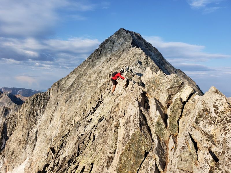
Among Colorado’s 58 fourteeners (mountains exceeding 14,000 feet), Capitol Peak stands as the most technically challenging and dangerous. The infamous Knife Edge—a 150-foot granite ridge with thousand-foot drops on both sides—must be straddled or traversed with careful hand placements.
Many climbers have died here after choosing incorrect routes or getting caught in afternoon thunderstorms. Unlike many popular mountains, there are no easy shortcuts or bailout options once committed to the upper sections.
The standard route involves 17 miles round-trip with 5,300 feet of elevation gain, requiring rock climbing skills, route-finding ability, and a cool head for extreme exposure.
7. The Precipice Trail – Acadia’s Vertical Iron Ladder
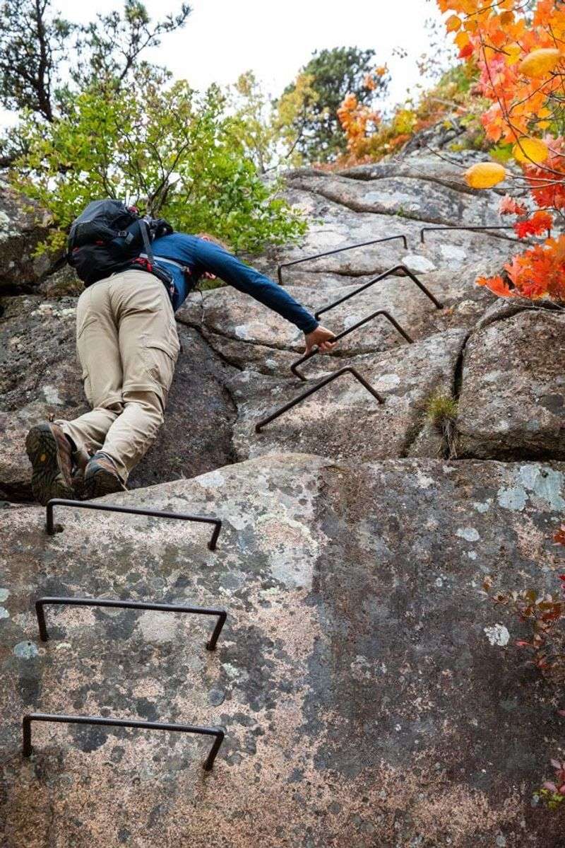
Resembling a European via ferrata more than a typical American hiking trail, The Precipice delivers heart-pounding thrills along the vertical face of Champlain Mountain. Iron rungs, ladders, and handrails bolted directly into granite cliffs assist climbers in navigating 1,000-foot drops.
Unlike climbing routes with safety harnesses, a slip here means certain disaster. The trail frequently closes for peregrine falcon nesting season, concentrating hikers during limited open periods.
Even experienced hikers find themselves white-knuckling certain sections where crosswinds create additional challenges. The reward comes in spectacular Atlantic Ocean views that stretch to the horizon – if you can take your eyes off the precipitous drops below.
8. Bright Angel Trail – The Grand Canyon’s Deceptive Descent
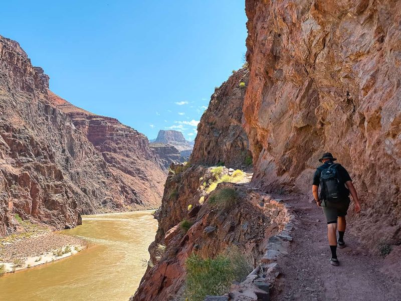
Luring unprepared hikers with its seemingly easy downhill start, Bright Angel Trail claims more rescues than any path in America. The problem isn’t going down—it’s coming back up 4,380 vertical feet in summer temperatures that regularly exceed 110°F at the bottom.
The Colorado River beckons 9.5 miles from the rim, but rangers maintain a “rescue notebook” filled with stories of hikers who couldn’t make the return climb. Inner canyon temperatures can be 20-30 degrees hotter than the rim, creating an environment where sweat evaporates instantly and dehydration strikes quickly.
Park rangers have a saying: “Going down is optional, coming up is mandatory.”
9. Mount Rainier Summit – Washington’s Glacier Gauntlet
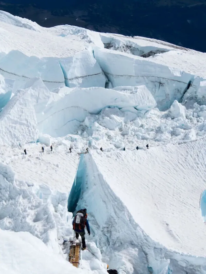
Standing 14,411 feet above sea level, this massive stratovolcano demands technical mountaineering skills beyond hiking. Crevasses hundreds of feet deep hide beneath snow bridges that can collapse without warning, while avalanches regularly sweep established routes.
Weather changes dramatically at high elevations, trapping climbers in whiteout conditions where navigation becomes impossible. Nearly 400 people have died attempting Rainier since records began.
Most summit attempts follow a two-day route with an overnight stay at Camp Muir (10,188 feet). Climbers must be proficient with ice axes, crampons, and rope team travel. Despite these challenges, approximately 10,000 people attempt the summit annually, with only about half succeeding.
10. Huckleberry Trail – Glacier National Park’s Grizzly Highway
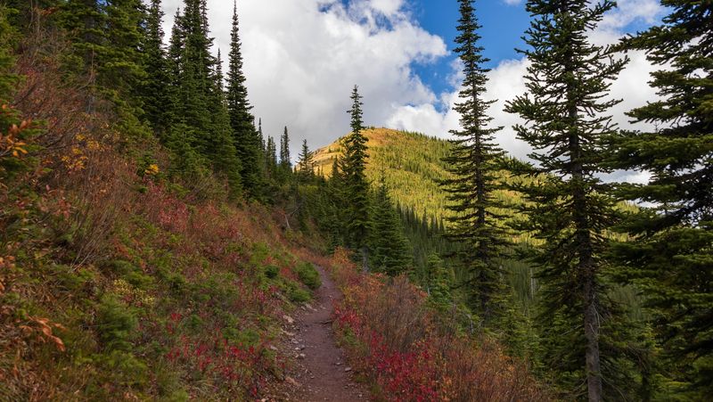
Winding through prime grizzly bear habitat, this remote trail in Glacier National Park’s backcountry combines wildlife danger with challenging terrain. Dense vegetation creates blind corners where surprising a bear becomes a real possibility.
Park rangers nickname certain sections “jungle gyms” for the number of downed trees hikers must climb over, under, or around. Flash floods regularly wash out bridges, forcing dangerous stream crossings.
Despite—or perhaps because of—these challenges, the trail offers unparalleled solitude among alpine meadows bursting with wildflowers. Hikers must carry bear spray, make noise constantly while hiking, and know proper bear encounter protocols to safely experience this wilderness.
11. Mount Katahdin Knife Edge – Maine’s Precarious Ridge Walk
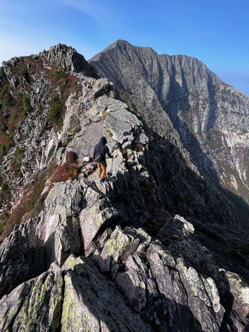
Forming the northern terminus of the Appalachian Trail, Mount Katahdin saves its greatest challenge for last. The Knife Edge trail connects Baxter and Pamola peaks via a spine-like ridge barely three feet wide in places, with drops exceeding 2,000 feet on either side.
Fierce winds regularly exceed 50 mph along this exposed route, sometimes strong enough to knock hikers off balance. Unlike western mountains, no safety cables or chains exist here—just raw rock and air.
Weather changes rapidly at this elevation, with fog reducing visibility to mere feet. The 1.1-mile Knife Edge section has claimed multiple lives, yet remains a bucket-list achievement for serious northeastern hikers.
12. Rattlesnake Arches – Colorado’s Desert Puzzle
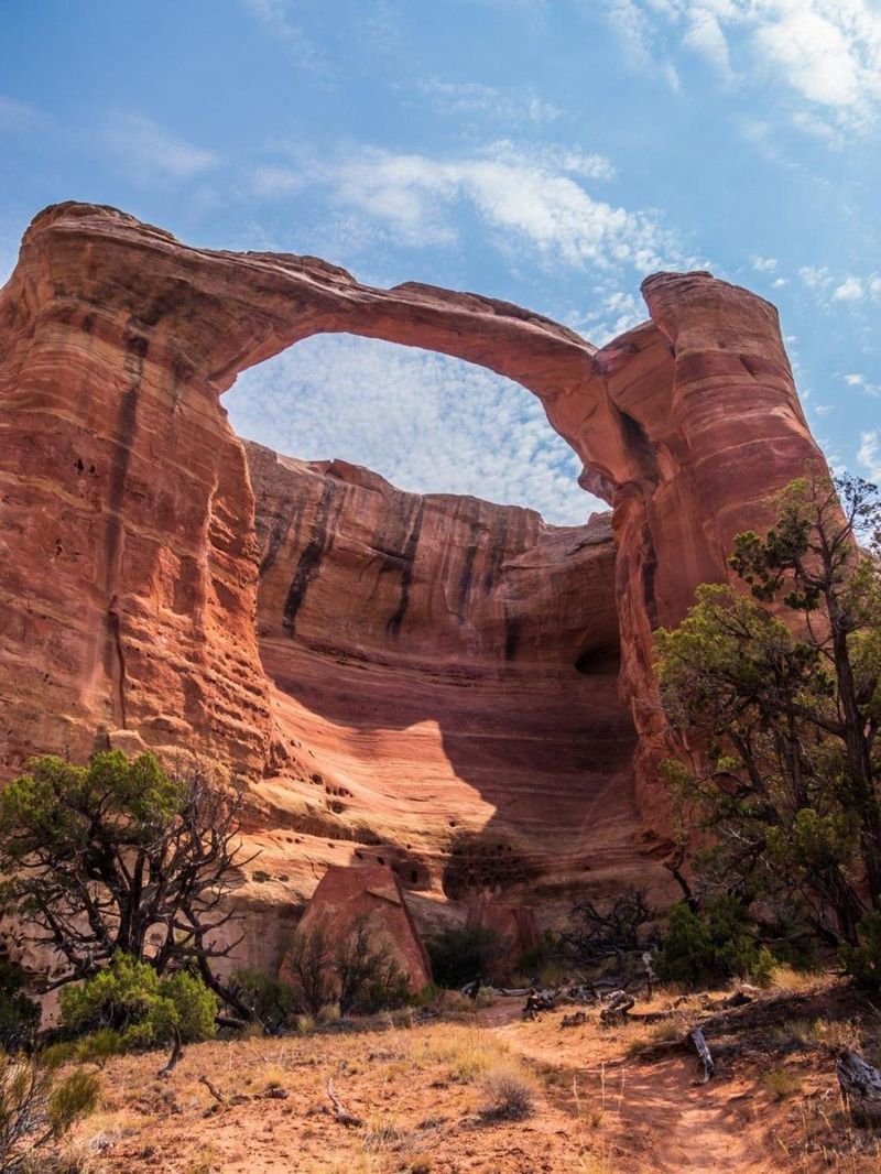
Home to the second-largest concentration of natural stone arches outside Utah, this remote trail demands serious route-finding skills. Cairns (rock piles) provide the only navigation markers through a landscape where wrong turns lead to dead-ends or dangerous cliff edges.
Summer temperatures regularly exceed 100°F with zero shade available. Rattlesnakes—the trail’s namesake—sun themselves on rocks along the path, creating hazards for the unwary.
Water sources don’t exist here, forcing hikers to carry everything they need. The trail’s isolation means emergency help remains hours away at best. Yet those who navigate these challenges discover a wonderland of massive sandstone arches without the crowds found at more famous destinations.
13. Grand Teton Summit – Wyoming’s Technical Alpine Test
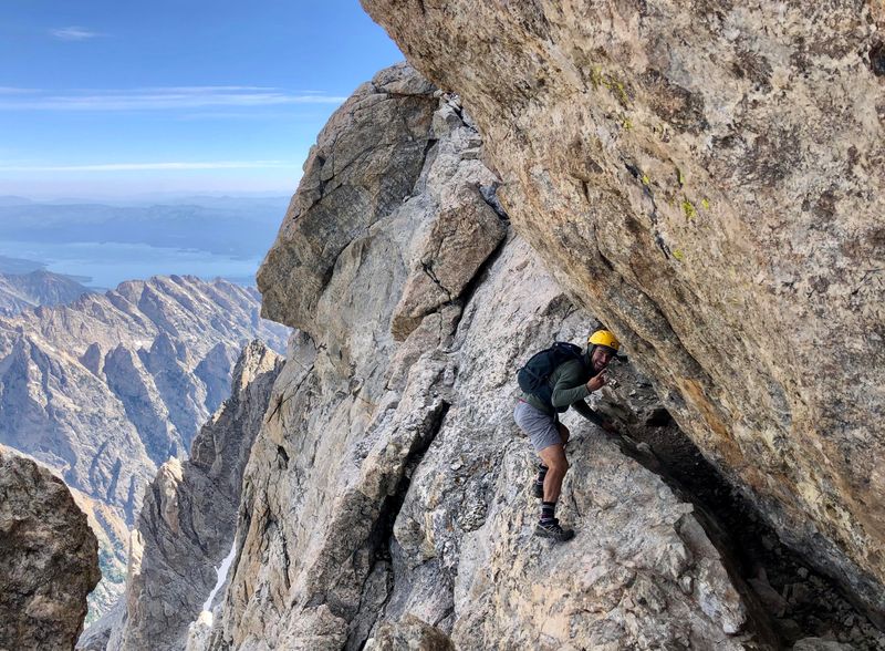
Reaching the 13,770-foot summit of the Grand Teton requires genuine rock climbing skills beyond hiking. The standard route involves 7,000 feet of elevation gain with technical sections rated 5.4 on the climbing scale—difficult enough to require ropes and protection.
Rockfall poses a constant threat as climbers above dislodge stones that accelerate to deadly speeds. Lightning strikes are common during afternoon thunderstorms that develop with little warning.
Most climbers tackle this as a two-day adventure with an overnight at the Lower Saddle (11,600 feet). The mountain’s severe weather, technical difficulty, and high elevation combine to create one of America’s most challenging and rewarding mountain adventures.
14. Mist Trail – Yosemite’s Slippery Waterfall Staircase
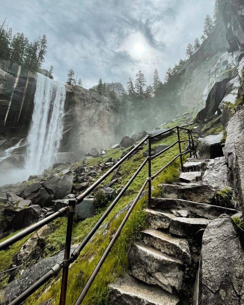
Following the thundering Merced River past two massive waterfalls, this popular trail becomes treacherous where its name derives—the perpetually wet granite staircase alongside Vernal Fall. Water vapor creates slick conditions on smooth stone steps with minimal guardrails protecting hikers from the powerful current.
Multiple fatalities occur here when visitors ignore warning signs and enter the river above the falls. One tragic incident in 2011 saw three hikers swept over the 317-foot waterfall after climbing over safety railings.
During peak snowmelt in spring, the trail lives up to its name as hikers get soaked by spray while navigating the steep stone steps. The combination of crowds, slippery conditions, and deadly consequences for missteps makes this Yosemite’s most hazardous popular trail.
15. Buckskin Gulch – Utah’s Claustrophobic Slot Canyon
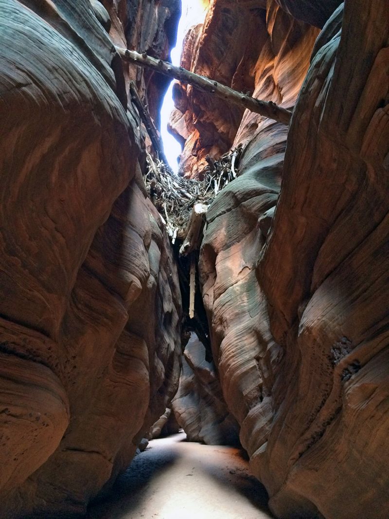
Stretching for 15 miles through sandstone walls that narrow to just 2 feet wide in places, Buckskin Gulch stands as the longest and deepest slot canyon in the Southwest. Flash flood danger here isn’t just theoretical—it’s a certainty during thunderstorm season.
Canyon walls rise up to 500 feet while offering few escape routes. Water from storms dozens of miles away can arrive without warning, turning the dry canyon floor into a raging torrent within minutes.
Massive logjams wedged between walls require technical climbing moves to overcome. Despite these dangers, the otherworldly beauty of light filtering through narrow openings draws adventurers willing to check weather forecasts obsessively before entering.

