Affiliate disclosure: As an Amazon Associate I earn from qualifying purchases. Learn more
At the very bottom of Texas, a single ribbon of road stretches across open water for more than two miles. It costs nothing to drive, yet it may be one of the most memorable minutes of any Gulf Coast road trip.
Time it for the end of the day, and the bridge becomes the main event instead of just the way to the beach. Here is everything worth knowing before you hit the gas.
A Bridge at the Bottom of the Map
Some road trips end at a sign. This one ends at a bridge.
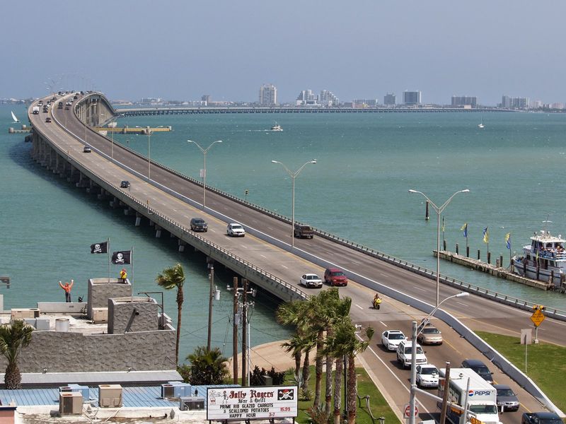
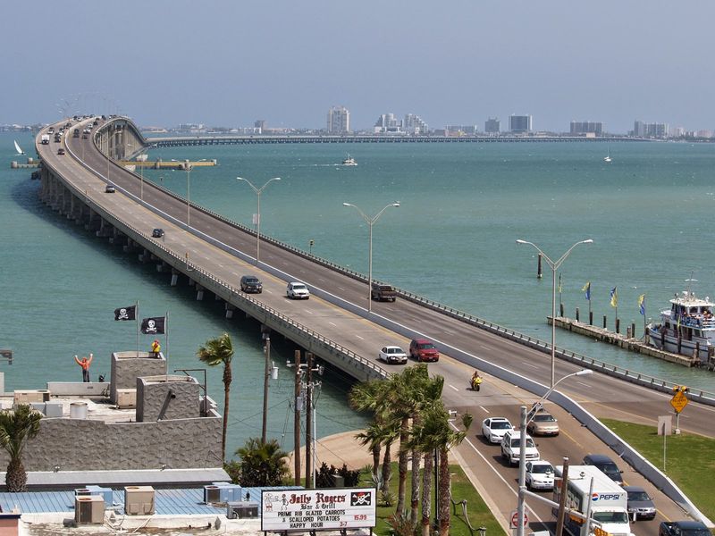
The Queen Isabella Causeway carries State Highway 100 between Port Isabel and South Padre Island, Texas, USA. It sits in the far southern tip of the state, in Cameron County, not far from the Mexican border.
The span runs roughly 2.4 miles across the Laguna Madre, the shallow bay that separates the mainland from the barrier island. That length is typically cited as the longest of any bridge in Texas.
For most travelers, it is the only road link to South Padre Island. Every beach day, family vacation, and spring getaway on the island starts and ends with a trip over this concrete arc.
Port Isabel anchors the mainland side with its small downtown and historic lighthouse. South Padre Island waits on the other end with its hotels, beaches, and Gulf views.
The causeway is not a tourist attraction with a gate or a ticket booth. It is a working highway, used daily by locals, delivery trucks, and road-trippers alike.
Still, plenty of Texans treat the crossing as a highlight of the journey rather than a formality. Once you know its story, the drive tends to feel a lot less ordinary.
Named for a Spanish Queen
Here is a fun trivia question for the car: why does a Texas bridge carry the name of a Spanish monarch?
The causeway honors Queen Isabella I of Castile, the royal who backed the voyages of Christopher Columbus in 1492. The name also ties into Port Isabel itself, a town whose identity leans on that Spanish heritage.
The current bridge opened in 1974. It replaced an older, lower causeway that had served the island since the 1950s.
That earlier crossing helped turn South Padre Island from a remote sandbar into a growing vacation spot. The newer, taller span gave boats more room to pass underneath and gave drivers a far smoother trip.
In 2001, a string of barges struck the bridge and knocked out several sections. Repairs took weeks, and the island relied on ferries during that stretch.
The causeway reopened later that year with added safety features, including warning systems near the water. Today it stands as a reminder of how much the region depends on one strong link.
So the next time someone in the back seat asks who Queen Isabella was, you will have a better answer than a shrug.
The Laguna Madre Below
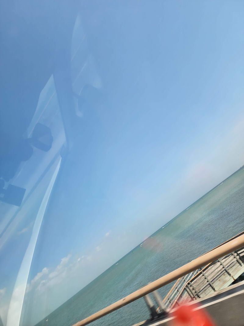
A bridge is only as interesting as what it crosses, and this one crosses something special.
The Laguna Madre is a long, shallow lagoon running along the Texas coast. It is one of only a handful of hypersaline lagoons in the world, meaning its water is often saltier than the open Gulf.
From the causeway, the bay spreads out wide on both sides. On a clear day, drivers can usually spot fishing boats, kayakers, and the occasional sailboat moving across the water.
The lagoon is popular with anglers who come for redfish, speckled trout, and flounder. Many of them launch from marinas in Port Isabel, so boat traffic under the bridge is common.
Birders also know this stretch of coast well. Pelicans, herons, and other shorebirds frequently work the shallows near both ends of the span.
Passengers get the best look, since drivers should keep their focus on the road. Assign the window seat to whoever promised to take photos.
Knowing what lies below turns a quick crossing into a mini lesson in Texas coastal geography, no textbook required.
Why the Hump Matters
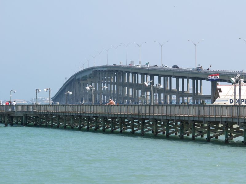
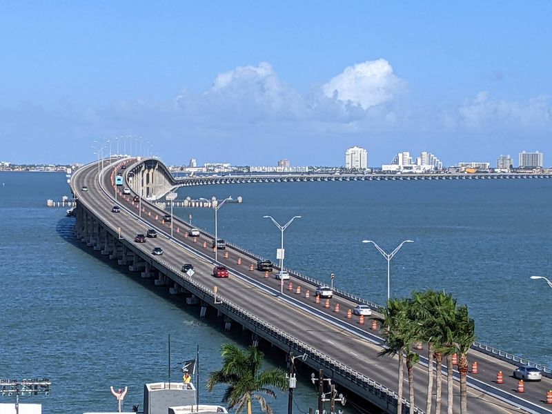
Most of the causeway runs fairly low over the water. Then, near the middle, the road climbs.
That raised center section exists for a practical reason. The Gulf Intracoastal Waterway passes beneath it, and tugboats pushing barges need enough clearance to get through.
For drivers, the climb is the fun part. At the top, the view opens up in every direction, with the island skyline ahead and the mainland shrinking behind.
Kids in the back seat often treat the hump like a mild roller coaster. Adults tend to enjoy it too, even if they will not admit it.
Wind can be stronger at the peak, so a firm grip on the wheel is a smart habit. Drivers towing trailers or campers may want to take it a little slower.
There is no shoulder for stopping on the bridge itself. Any photos from the summit belong to passengers, not the person driving.
A few seconds at the top are all you get, and that short window is exactly what makes the moment worth paying attention to.
Chasing the Golden Hour
Timing is everything, and this bridge rewards anyone who plans around the clock.
The Laguna Madre lies west of South Padre Island. That means drivers heading back toward Port Isabel in the evening are pointed straight at the setting sun.
Many travelers schedule a beach day on the island and then cross back to the mainland right at dusk. The result is a drive with the sky and bay filling the windshield.
Sunglasses and a clean windshield help a lot. Low sun can make visibility tricky, so leave a little extra space between cars.
Prefer to watch rather than drive? Both ends of the causeway have waterfront spots where people park and watch the bridge silhouetted against the sky.
On the island side, the bay shoreline near the base of the bridge is a popular evening hangout. In Port Isabel, the area around the lighthouse offers an elevated view of the span.
Check the sunset time on your phone before leaving the beach. Arriving ten minutes late is the most common regret here, and nobody wants that souvenir.
Free Crossing, Big Payoff
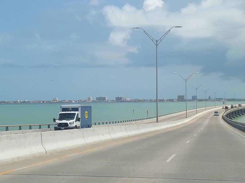
Good news for anyone watching the travel budget: the causeway costs exactly zero dollars.
There is no toll to drive across in either direction. You can cross once, twice, or as many times as your road trip requires.
That makes it one of the best free scenic drives on the Texas coast. A family of five gets the same view as a solo traveler, without anyone reaching for a wallet.
Free does not mean bare bones, either. The bridge has two lanes in each direction, so traffic usually keeps moving outside of the busiest weekends.
Spring break and summer holidays can bring heavier traffic. Crossing on a weekday or early in the morning typically means a smoother ride.
Pair the drive with other no-cost activities nearby, such as public beach access on the island or strolling Port Isabel’s waterfront. It is easy to fill an afternoon without spending much.
For Texans who love a deal, few bragging rights beat telling friends you drove the longest bridge in the state for free.
Port Isabel on the Mainland Side
Before the bridge, there is a small town with a big lighthouse.
Port Isabel sits at the western end of the causeway. Its best known landmark is the Port Isabel Lighthouse, built in 1852 and now part of a state historic site.
Climbing the lighthouse is a popular way to see the causeway from above. Admission is usually modest, though prices and hours can change, so checking ahead is wise.
The town also has a compact historic district with shops and museums. It makes a handy stop for stretching legs after a long drive south.
Families often use Port Isabel as a base because it can be quieter than the island. The bridge puts the beach only a few minutes away.
Waterfront parks and pull-offs along the bay give clear views of the span. These spots tend to fill up near sunset, which says plenty about how locals feel about the scene.
Give the town at least an hour before heading across. It adds a layer of history to the trip that the bridge alone cannot provide.
What Waits on the Island
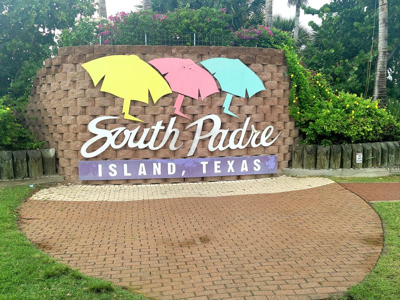
Cross the final stretch, and the road drops you right into South Padre Island.
The island is a long, narrow barrier island with the Gulf of Mexico on one side and the Laguna Madre on the other. The causeway lands near the southern end, where most hotels, shops, and attractions cluster.
Beaches line the Gulf side, and many have public access points. Parking at several beach accesses is often free, though some areas may charge.
The bay side is calmer and popular for kayaking, paddleboarding, and wind sports. It is also where many people gather for evening views of the bridge.
Families can find nature centers, a birding center, and sea turtle education programs on the island. Hours and fees vary, so a quick check online saves surprises.
Head north and development thins out quickly. The road eventually gives way to wilder stretches of sand and dunes.
Having the island on one end and history on the other means the causeway connects two very different kinds of fun, all within a few miles.
Getting There From Big Texas Cities
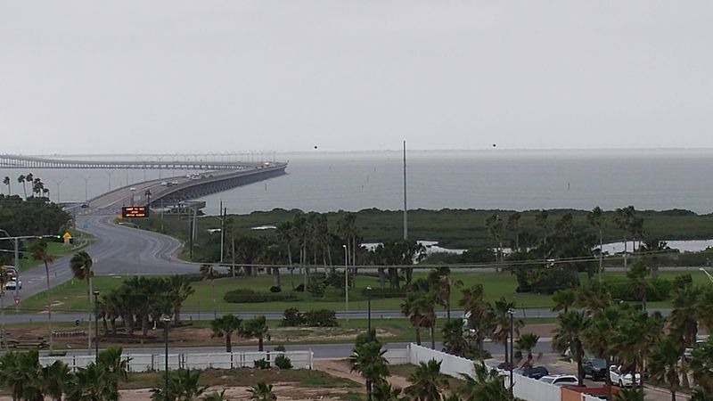
Nobody stumbles onto this bridge by accident. Reaching it takes some commitment.
From San Antonio, the drive typically runs about four and a half hours. Houston and Austin are usually around five to six hours away, depending on route and traffic.
Dallas and Fort Worth travelers face a longer haul, often eight to nine hours. Many split the trip with an overnight stop along the way.
Most routes funnel through the Rio Grande Valley and onto State Highway 100 toward Port Isabel. From there, the causeway is impossible to miss.
The nearest major airports are in Brownsville, Harlingen, and McAllen. Brownsville is roughly a 30 to 40 minute drive from the bridge.
The causeway is open around the clock as a public highway. Weather can occasionally affect conditions, especially during strong winds or tropical storms, so check road updates in hurricane season.
Pack water, sunglasses, a phone charger, and a fully charged camera for passengers. A little preparation keeps the focus on the drive instead of the gas station hunt.
Worth Every Mile of the Drive
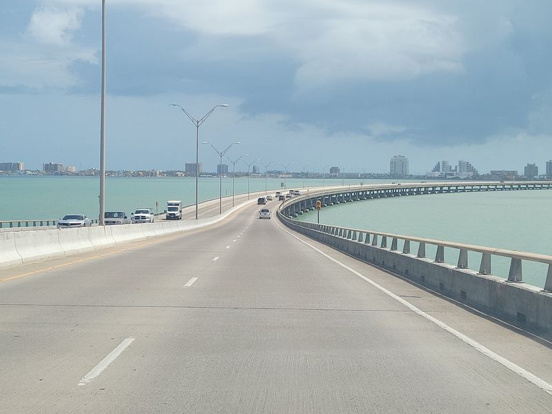
Long drives deserve a proper finale, and South Texas delivers one made of concrete and open water.
The Queen Isabella Causeway checks the boxes many Texas road-trippers care about. It is free, family friendly, and distinctly Texan as the longest bridge in the state.
It also packs a lot of story into a short crossing. A Spanish queen’s name, a working waterway below, and a dramatic chapter in 2001 all add depth to a few minutes behind the wheel.
Families tend to remember the climb over the hump. Couples and photographers usually remember the evening light over the bay.
Is it worth driving hours just for a bridge? On its own, maybe not for everyone.
Paired with Port Isabel’s lighthouse and a day on South Padre Island, though, it becomes the moment that ties the trip together. Plenty of Texans make the journey year after year for exactly that reason.
Plan your return crossing for sunset, hand the camera to a passenger, and let the longest bridge in Texas close out the day.