
Getting lost on a hiking trail can turn an amazing adventure into a scary situation. Modern GPS and navigation tools have completely changed how we explore the outdoors, giving us confidence to tackle new trails safely. Whether you’re planning a weekend hike or a multi-week backpacking trip, having the right navigation tool can make all the difference between a memorable journey and a dangerous mistake.
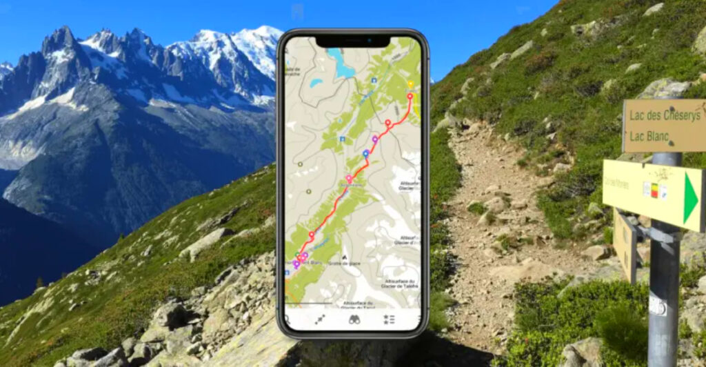
1. AllTrails (iOS/Android) — Best for finding popular trails + wrong-turn alerts
AllTrails makes your phone buzz with a gentle reminder that you’ve wandered off course with their incredible wrong-turn alert feature that keeps you safely on track.
With over 450,000 trails in their massive database, finding your next adventure becomes as easy as scrolling through social media. The AllTrails+ subscription adds offline maps, so you can navigate even when cell towers are miles away.
Perfect for beginners and experienced hikers alike, this app combines user reviews, photos, and detailed trail information to help you choose the right path for your skill level.
2. Gaia GPS (iOS/Android/Web) — Best for detailed topo layers & backcountry nav
When serious backcountry explorers need detailed terrain information, Gaia GPS delivers with professional-grade topographic maps that reveal every ridge, valley, and water source. Weather overlays help you track incoming storms before they catch you off guard.
The premium map layers include everything from satellite imagery to specialized hunting and fishing maps. You can plan routes on your computer at home, then sync everything to your phone for offline use in the wilderness.
Mountaineers and wilderness guides trust Gaia GPS because it provides the kind of detailed information that keeps adventurers safe in remote locations where mistakes can be costly.
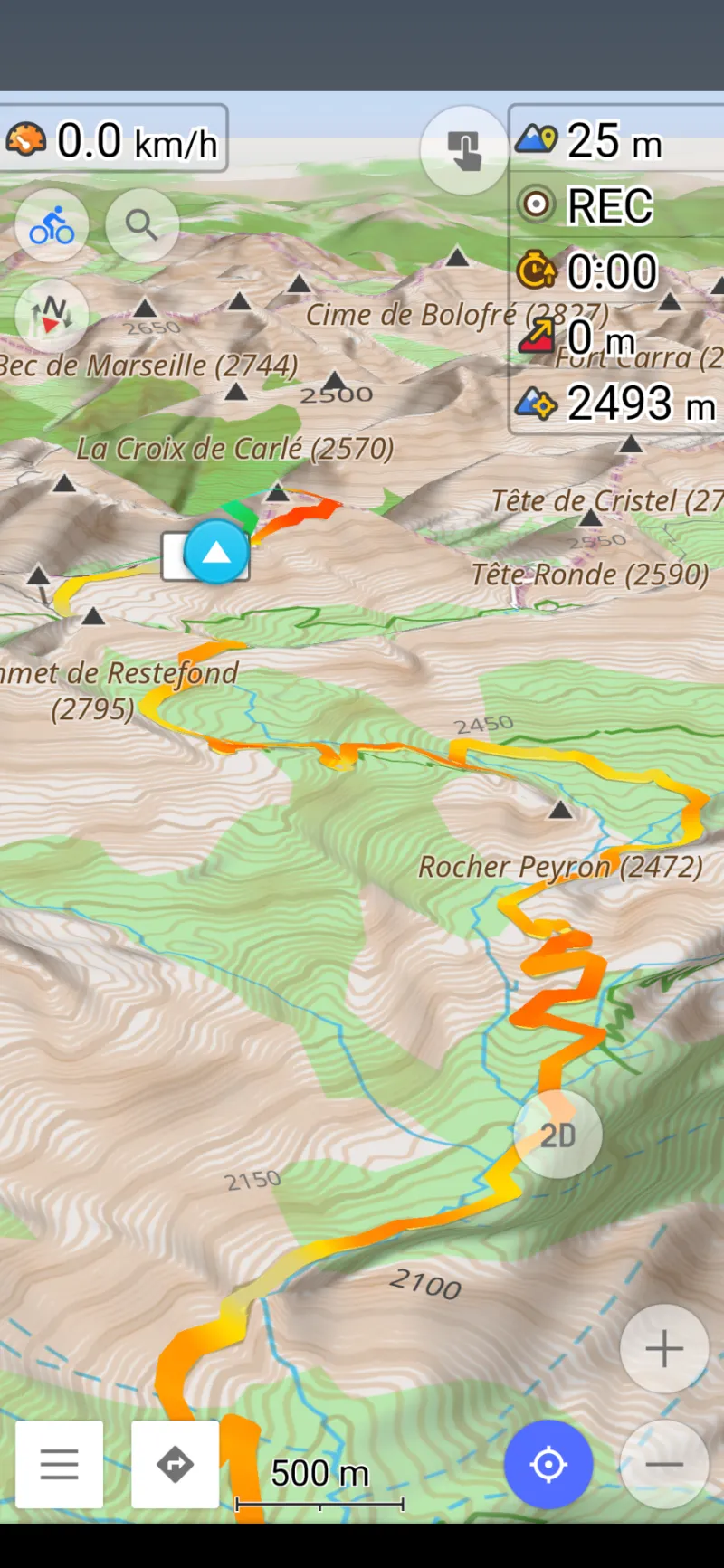
3. CalTopo (iOS/Android/Web) — Best for planning routes with slope & avalanche tools
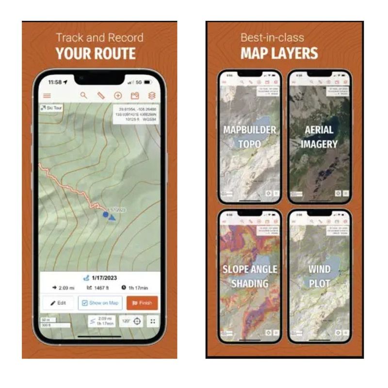
Search and rescue teams across the country rely on CalTopo for its incredibly detailed slope analysis and terrain assessment tools. The slope angle shading feature instantly shows you which areas might be dangerous during avalanche season.
Planning becomes almost addictive when you can customize every map layer, from weather data to fire restrictions. Print custom maps at home before your trip, or download everything to your phone for offline access.
Mountain guides love how CalTopo helps them evaluate terrain risks before committing to a route. The aspect shading feature shows which slopes get morning sun versus afternoon exposure, crucial information for timing your climbs.
4. onX Backcountry (iOS/Android/Web) — Best for mountain layers (slope/avalanche) + offline
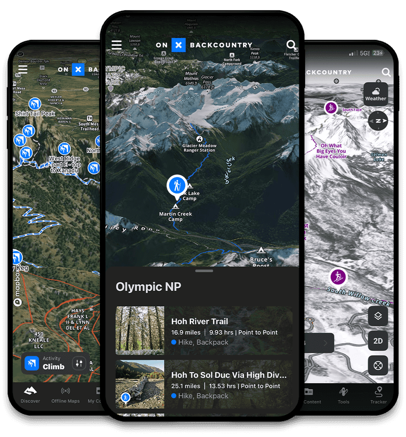
Ski tourers and alpine hikers have found their perfect companion in onX Backcountry, which specializes in mountain-specific navigation features. The slope angle shading immediately shows you where the terrain gets sketchy, helping you avoid dangerous areas.
Download detailed offline maps from the web interface straight to your phone before heading into areas with no cell service. The avalanche layer integration provides crucial safety information for winter adventurers.
Built specifically for people who love steep terrain, onX Backcountry understands that mountain navigation requires specialized tools. The interface feels intuitive even when you’re wearing gloves in cold weather conditions.
5. Avenza Maps (iOS/Android) — Best for official NPS/USFS maps offline
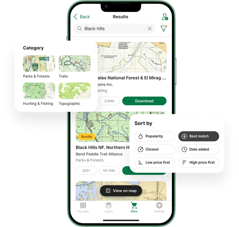
National Park Service rangers often recommend Avenza Maps because it loads the same official GeoPDF maps that park agencies create for each area. These aren’t generic maps – they’re the real deal with current trail conditions and regulations.
The Avenza store includes hundreds of free official maps from National Parks and Forest Service locations across the country. Download them before your trip and navigate completely offline without worrying about data charges.
When park agencies update their official maps with new trail closures or camping regulations, Avenza Maps ensures you’re getting the most current and accurate information available for your destination.
6. FarOut (formerly Guthook) (iOS/Android) — Best for thru-hiking trail guides
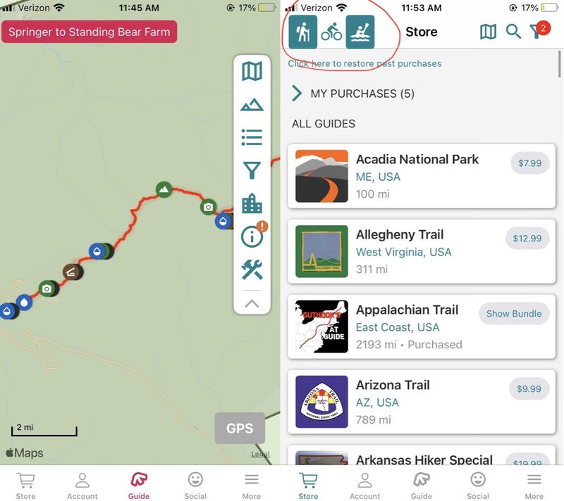
Thru-hikers on famous trails like the Pacific Crest Trail and Appalachino Trail consider FarOut essential because it provides crowdsourced information about water sources, campsites, and trail conditions updated by fellow hikers.
Real hikers share current information about bridge washouts, water availability, and the best camping spots along your route. The elevation profiles help you plan daily mileage based on terrain difficulty.
User comments create a virtual trail community where experienced hikers share tips about resupply points, weather conditions, and hidden gems along the way. Perfect for multi-day adventures where local knowledge makes the difference between comfort and misery.
7. Locus Map 4 (Android/iOS) — Best for power users who want everything
Tech-savvy hikers who want complete control over their navigation experience gravitate toward Locus Map 4 because it offers more customization options than any other hiking app. The LoMaps vector system provides incredibly detailed offline maps.
Route planning becomes incredibly sophisticated with elevation analysis, turn-by-turn directions, and the ability to create complex multi-day itineraries. Different map themes optimize display for hiking, biking, or skiing activities.
Frequent 2025 updates have improved the planning interface and added LoPoints integration for sharing waypoints with other users. The learning curve is steeper than simpler apps, but the functionality rewards dedicated users with professional-level features.
8. OsmAnd (iOS/Android) — Best open-source topo with contours/hillshade
Privacy-conscious hikers appreciate that OsmAnd operates completely offline using OpenStreetMap data without tracking your location or selling your information to advertisers. The topography plugin adds professional-quality contour lines and hillshade rendering.
Since it’s open-source software, a global community of developers continuously improves the app and adds new features based on user feedback. Map updates come directly from the collaborative OpenStreetMap project.
The interface might feel less polished than commercial apps, but the functionality is rock-solid for serious navigation. Slope analysis and detailed elevation data make it suitable for technical hiking where accuracy matters more than flashy graphics.
9. Organic Maps (iOS/Android) — Best privacy-first offline maps
Battery life becomes crucial during long hiking days, and Organic Maps excels by using minimal power while providing reliable offline navigation. Zero tracking means your location data stays completely private on your device.
The clean, simple interface focuses on essential navigation features without overwhelming you with complicated options. Popular hiking and cycling routes appear clearly marked, making it easy to find established trails.
Built from OpenStreetMap data, Organic Maps proves that effective navigation doesn’t require sacrificing your privacy or draining your phone battery. The lightweight design makes it perfect for multi-day trips where every bit of battery power counts toward your safety.
10. Apple Maps (iOS 18+, iPhone & Apple Watch) — Best built-in hiking maps for iPhone users
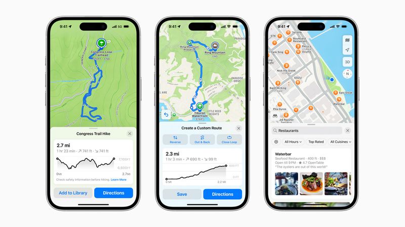
iPhone users finally have a built-in hiking solution that rivals dedicated apps, thanks to Apple’s addition of topographic maps covering all 63 U.S. national parks plus detailed topo data for the entire United States and Japan.
Seamless integration with Apple Watch means you can navigate without pulling out your phone, preserving battery life and keeping your hands free for scrambling over rocks. Offline support ensures reliability in remote areas.
The familiar Apple interface requires no learning curve, and automatic syncing across your devices means routes planned on your iPad appear instantly on your iPhone and watch during the hike.
11. Google Maps (iOS/Android) — Best general backup with offline + terrain
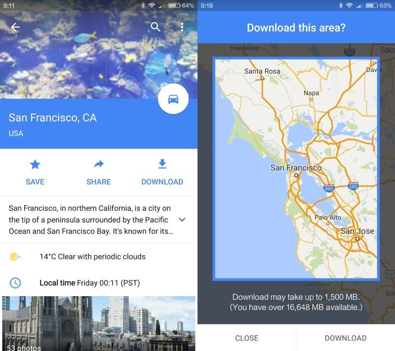
Everyone already has Google Maps installed, making it the ultimate backup navigation tool when specialized hiking apps fail or run out of battery. The terrain layer reveals contour lines and elevation changes for basic topographic information.
Download offline maps before heading into areas with poor cell coverage, ensuring you maintain basic navigation capability even when other apps struggle. The familiar interface means no learning curve during stressful situations.
While not as detailed as dedicated hiking apps, Google Maps excels at getting you to trailheads and providing general area orientation. The satellite imagery helps identify landmarks and terrain features that might not show up on traditional topographic maps.
12. Garmin GPSMAP 67i (handheld) — Best do-it-all handheld with SOS
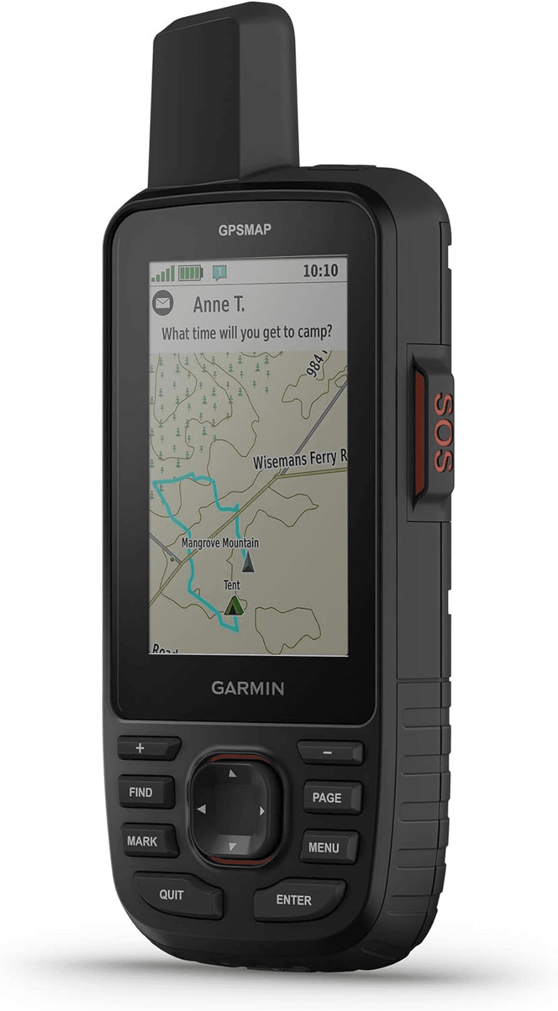
Serious wilderness adventurers who venture beyond cell phone reliability trust the GPSMAP 67i because it combines professional-grade GPS navigation with life-saving satellite communication in one rugged device that survives drops, water, and extreme temperatures.
Multi-band GNSS reception works under tree cover and in deep canyons where smartphones lose signal completely. The built-in inReach satellite system provides two-way messaging and emergency SOS capability anywhere on Earth.
Battery life measured in weeks rather than hours makes this perfect for extended expeditions where charging opportunities don’t exist. The price reflects its professional capabilities, but for remote wilderness travel, it’s genuinely life-saving technology.
13. Garmin inReach Mini 2 (satellite communicator) — Best ultralight SOS + breadcrumb nav
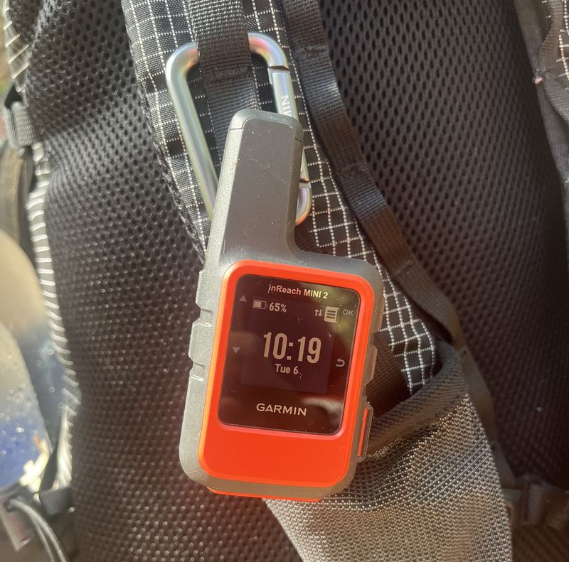
Weighing less than four ounces, the inReach Mini 2 provides life-saving satellite communication without the bulk of traditional emergency beacons. The breadcrumb navigation feature tracks your route, making it easy to retrace your steps if weather or darkness forces a retreat.
Two-way messaging lets you stay in touch with family and coordinate with hiking partners even in areas with zero cell coverage. The SOS button connects directly to professional rescue coordination centers worldwide.
Pair it with your smartphone for detailed mapping, or use the built-in compass and TracBack feature for basic navigation. Ultra-light backpackers love how it provides essential safety features without adding significant weight to their carefully planned gear lists.

