
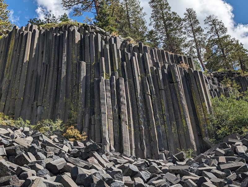
Affiliate disclosure: As an Amazon Associate I earn from qualifying purchases. Learn more
Ireland has a famous coastline lined with stone columns so neat they seem cut by hand. California has its own version, and it sits in the Eastern Sierra, just past Mammoth Lakes.
No passport, no long flight, no jet lag. A shuttle ride, a short forest walk, and suddenly a wall of tall, six-sided rock columns stands in front of you.
They formed from cooling lava about 100,000 years ago, and they still look almost too tidy to be natural. Kids treat the trail like an adventure, and grownups end up staring at the geology longer than planned.
A tall waterfall waits a couple of miles down the same path. Keep reading for the story behind the stone, the best trails, the shuttle details, and the timing tricks that help you skip the biggest crowds.
A Stone Wall Hiding in the Eastern Sierra
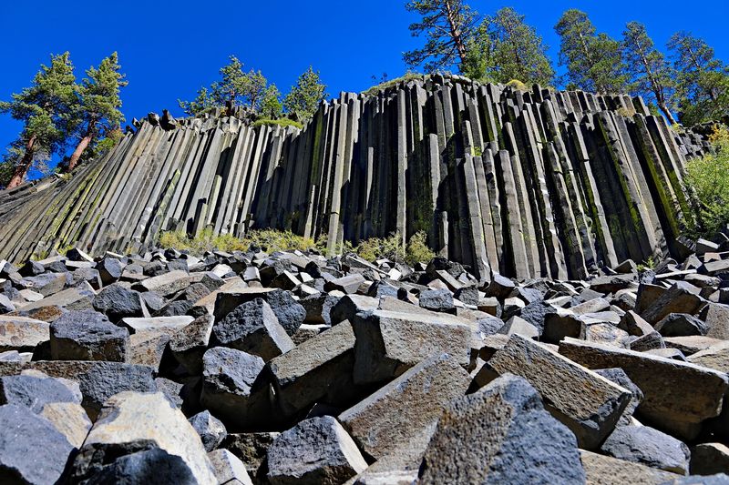
California’s answer to the Giant’s Causeway goes by a spooky name: Devils Postpile National Monument.
The official address is Devils Postpile Road, Mammoth Lakes, CA 93546, in the United States. It sits in the Sierra Nevada high country, a short distance from the town of Mammoth Lakes and Mammoth Mountain.
The monument is classified as a national reserve and is managed by the National Park Service. Its claim to fame is a landmark wall of columnar basalt, a rock formation shaped into tall, tightly packed columns.
Those columns are only part of the package. The monument also includes hiking trails, the San Joaquin River, and Rainbow Falls, one of the most popular waterfalls in the region.
Many Californians have driven past the Mammoth exits on Highway 395 for years without making the detour. That is a shame, because few places in the state pack this much geology into such a short walk.
The monument has earned a strong reputation, holding a 4.7-star average across more than 1,700 public scores on Google. That number says plenty about how often people leave planning a return trip.
So what exactly makes a pile of rock worth a mountain drive? The answer starts roughly 100,000 years ago.
Lava That Learned Geometry
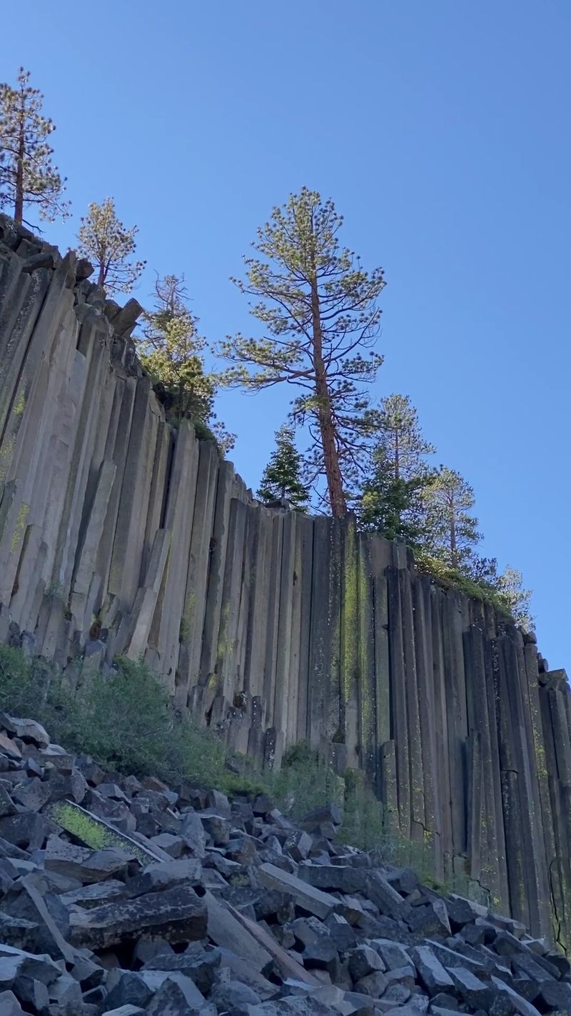
Long before ski lifts and shuttle buses, a lava flow filled this valley. As it slowly cooled, it cracked into long, many-sided columns.
The process happened about 100,000 years ago. Cooling rock shrinks, and when it shrinks evenly, it splits into shapes that often have five or six sides.
The result is a formation that looks remarkably uniform. The columns stand closely packed together, so neat that many first-timers assume someone built them.
Nobody did, of course. Nature simply had a very good day at the office.
The same basic process created the Giant’s Causeway in Northern Ireland, which explains the family resemblance. Both spots show what happens when a thick body of lava cools in just the right way.
Part of the fun here is how much of the story you can still read in the rock. Different column heights, slight bends, and broken pieces all hint at how the formation changed over time.
Rangers at the station near the trailhead can fill in more details. Their information makes the short walk to the wall feel a bit like a field trip, minus the permission slip.
Giant Pencils on the Valley Floor
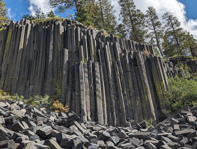
Look down before you look up. At the base of the wall, a jumble of fallen column pieces spreads across the slope.
These broken sections have a funny reputation. They look like giant snapped pencils dropped by someone who lost patience with a math test.
Columns break off over the centuries and tumble downhill, collecting into a rocky apron below the standing wall. That pile is how the monument got the “postpile” part of its name.
Up close, the scale becomes much more impressive. Standing next to the wall shows how tall the columns rise and how many there are packed side by side.
The shapes and patterns change as you move along the base. Some columns stand straight, others lean, and some curve slightly.
Families tend to linger in this spot. Kids enjoy scanning the rubble and comparing sizes, while adults study the wall itself.
Please stay on the marked paths and leave rocks where they lie. The formation has been around for a long time, and it would be nice to keep it that way for the next 100,000 years.
The Honeycomb on Top
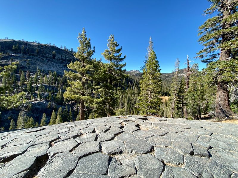
Most people stop at the base. The real secret sits overhead.
A short trail climbs to the top of the formation, where you can stand on the ends of the columns themselves. From above, the tops form a pattern of tight polygons, a bit like floor tiles laid by an unusually tidy crew.
Those distinctive shapes were created as the rock cooled. Seeing them from above helps the whole story click into place.
The climb is short, about a quarter mile, roughly the same distance as the walk to the base. The catch is that it is all uphill.
At this elevation, an uphill quarter mile can feel longer than it sounds. Some people find the climb quite challenging, so take it slowly and rest when needed.
There is no prize for racing. The columns will still be there when you arrive.
For anyone with steady legs and a little patience, this view is the payoff of the visit. It is the one part of the trip that many people say they almost skipped and are glad they did not.
An Easy Loop With Changing Views
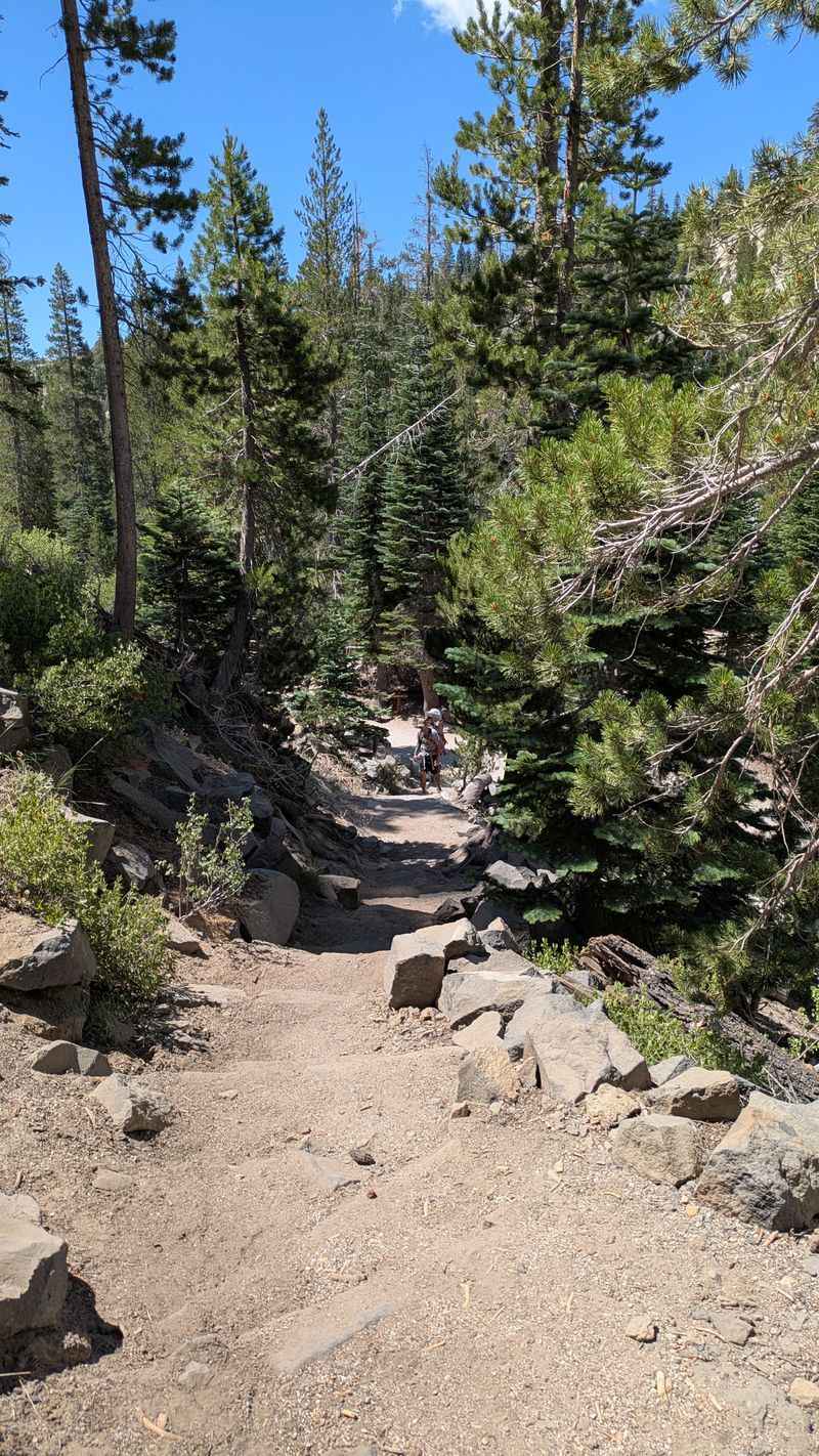
Good news for anyone who prefers walks over workouts. The main trail is short and widely described as easy.
From the ranger station, the formation is only a couple hundred yards away, and the walk to the base is about a quarter mile. Many people reach the columns in roughly 15 to 20 minutes from the parking area.
A loop trail continues around the formation. The columns appear along the route, so the view keeps changing as you move.
Different angles show different sides of the wall. One stretch highlights height, another shows the curve of the columns.
The loop can be a little taxing in spots, but it stays short. Signage can be confusing, so ask at the ranger station before setting out if you want the full circle.
The forest along the way is filled with tall pine trees and mountain views. It turns a quick stop into a real outdoor outing.
Some shade helps on warm days. Even so, an hour of hiking at this altitude will remind you that summer exists.
Rainbow Falls Steals the Second Act
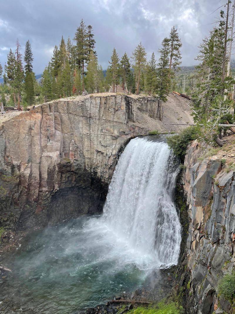
Just when it seems the rock wall is the whole show, the trail keeps going. Rainbow Falls waits a couple of miles beyond the Postpile on the same route.
The waterfall is one of the most talked-about parts of the monument. It drops along the San Joaquin River and is widely considered worth every step of the walk.
From the Postpile area, the hike to the falls runs about 2.5 to 2.7 miles. Many people combine both stops into one outing.
Another option starts at the Rainbow Falls Trailhead parking lot. From there, the trail heads downhill going and uphill coming back, so save some energy for the return.
Much of the route is open and sunny. Water, sunscreen, and a hat are practically required gear.
The falls get busy, especially in midday. Even so, the view rewards the effort, and it gives the trip a second highlight that pairs nicely with the columns.
Two landmarks for one hike is a solid deal in a state where everything seems to cost extra lately.
Lower Falls and Quieter Corners
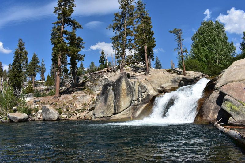
Crowds thin out fast once the trail passes Rainbow Falls. Continue downhill and you reach the Lower Falls.
Here the river takes a major turn. The spot draws fewer people than the main waterfall viewpoint.
It also offers plenty of room to explore. The area has more open space and a calmer pace than the busier stretches upstream.
Many hikers say the trek down to lower Rainbow Falls is a must. It adds distance, so plan time and water accordingly.
The San Joaquin River runs clear and very cold through this area. Use caution near the banks and around wet rocks.
Adding the Lower Falls turns the outing into a fuller day. It is the kind of detour that makes the trip feel personal rather than rushed.
For those who think the best parts of a park are the ones nobody else bothers to reach, this stretch fits that idea neatly.
Where Famous Long Trails Cross Paths
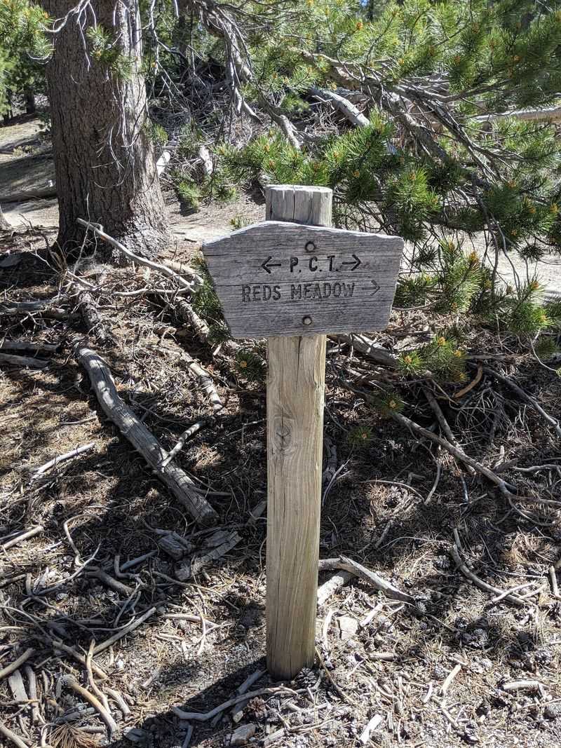
Here is a fun fact for trail fans. Both the John Muir Trail and the Pacific Crest Trail pass through this area.
Thru-hikers walking hundreds of miles share the same valley with families out for an afternoon. It is a small meeting point for two very different kinds of trips.
Day hikers can use a segment of these trails too. One option is to head north on the trail back toward the ranger station after visiting Rainbow Falls.
That stretch tends to be much quieter. While the Postpile loop and Rainbow Falls Trail can fill with people, the long-distance route often sees far fewer.
The views along the way are wide and open. It offers a taste of the backcountry without committing to a multi-week trek.
Check a map or ask a ranger before trying this route. Trail junctions can be easy to mix up.
Walking even a mile of these legendary paths makes a nice story for later. Telling friends you hiked the Pacific Crest Trail is technically true, after all.
Family Field Trip Material
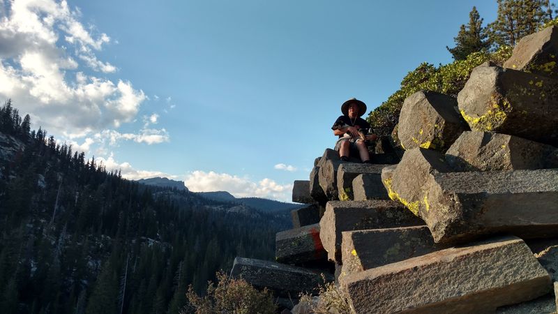
Kids and geology are not always a winning match. Here, they somehow get along.
The short trail is very doable for children, and many families finish with little complaining. That alone may qualify as a small miracle.
Young hikers enjoy the unusual shapes, the fallen columns, and the feeling of exploring. Adults can focus on the science and scenery at the same pace.
The visit blends education, adventure, and nature without requiring an all-day commitment. It works well for multiple generations traveling together.
Preparation matters, though. The open stretches toward Rainbow Falls can get warm, and some parents show up without enough supplies.
Pack water bottles, sunscreen, and hats for everyone. Snacks for the walk back never hurt either.
For grandparents who want a trip that gets the whole family outside, this one checks plenty of boxes. It is the type of outing kids may still mention years from now.
Mountain Air and Altitude Smarts
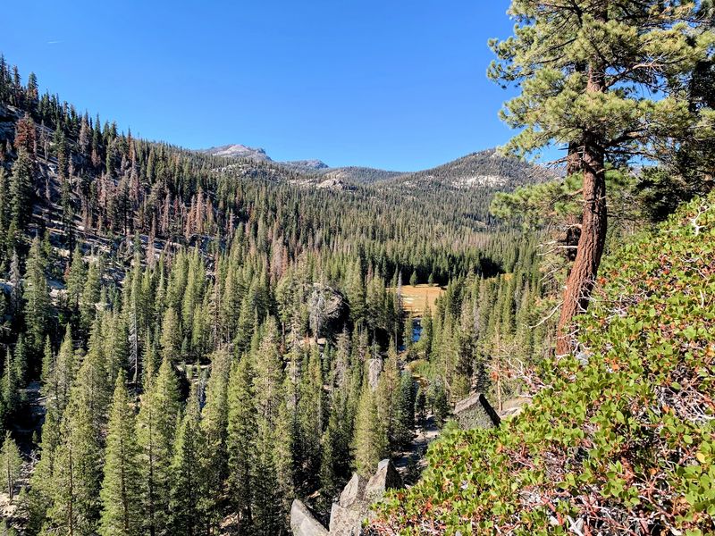
The monument sits high in the Sierra Nevada, and the elevation is significant. That fact shapes the whole experience.
Even easy trails can feel harder up here. Short climbs, such as the walk to the top of the Postpile, may leave you more winded than expected.
Taking your time is the smart approach. Rest breaks are perfectly normal, especially for anyone not used to mountain elevations.
Staying hydrated helps a lot. Bring more water than you think you need, especially for longer hikes like Rainbow Falls.
Sun exposure is another factor. Open sections of trail can get warm, so sunscreen and a hat belong in every pack.
Restrooms and a water fountain sit near the ranger station by the shuttle stop. Campground water in the area may not be potable, so it is safer to carry your own.
None of this should scare anyone away. A little planning simply keeps the day pleasant from the first step to the last.
The Shuttle Story
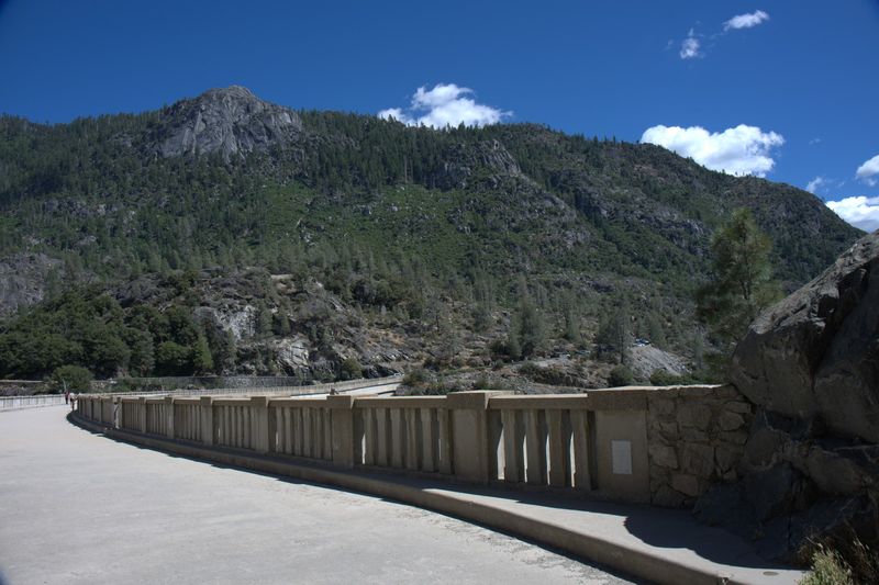
Getting there is part of the adventure. In many seasons, a shuttle bus is the main way in.
The shuttle departs from the Mammoth Mountain Adventure Center area, near the Mammoth statue. Recent tickets have cost about $15 per person, though prices may change.
Buses run roughly every 20 to 30 minutes and make about 10 stops. Stop number 6 is closest to Devils Postpile, followed by a short walk of about half a mile.
The ride takes around 30 minutes. Flush toilets sit near the drop-off point.
The shuttle has fans and critics. Some appreciate letting a professional handle the mountain driving, while others find the buses crowded and the ride long.
Catching an early bus helps. People who take the first shuttle, around 7:30 am in past seasons, often enjoy a few quiet hours before crowds arrive.
By late morning, lines at the Mammoth Mountain stop can grow. Planning ahead is the easiest way to spend more time on the trail than in line.
Driving the Narrow Road Down
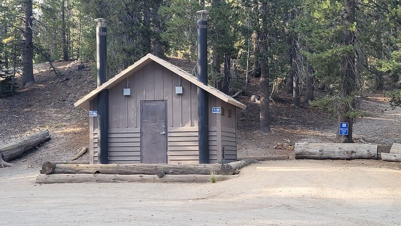
Some days, driving in is allowed. Timing and road conditions decide everything.
Early arrivals have been able to drive all the way to trailhead parking. In past seasons, getting there before 7 am made that possible.
The road deserves respect. It is narrow and winding, with one-lane stretches and very few wide spots to pull over.
Drivers pulling trailers or RVs should take extra care. Some find the descent a bit nerve-racking but doable.
The drive from the entrance to the trailhead can take about 35 to 40 minutes. The scenery along the way is lovely, so a passenger with a camera will stay busy.
A fee applies to enter the Reds Meadow Valley. Amounts may change, so check before you go.
Parking lots are small and fill quickly. In busy times, campgrounds have served as extra parking, but no one should count on that.
Hours, Seasons, and the Ranger Station
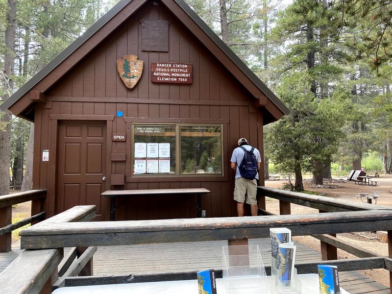
Plan around the calendar. Access to the monument is seasonal, and conditions can shift from year to year.
Listed hours run from 9 am to 5 pm, seven days a week, during the operating season. Shuttle schedules and road access may differ, so confirm details on the National Park Service website before the trip.
Road construction has affected access in recent seasons. At times, the area was open only on weekends, with many facilities limited.
Even then, the Postpile walk and some wilderness areas stayed open. Checking current conditions saves a long drive for nothing.
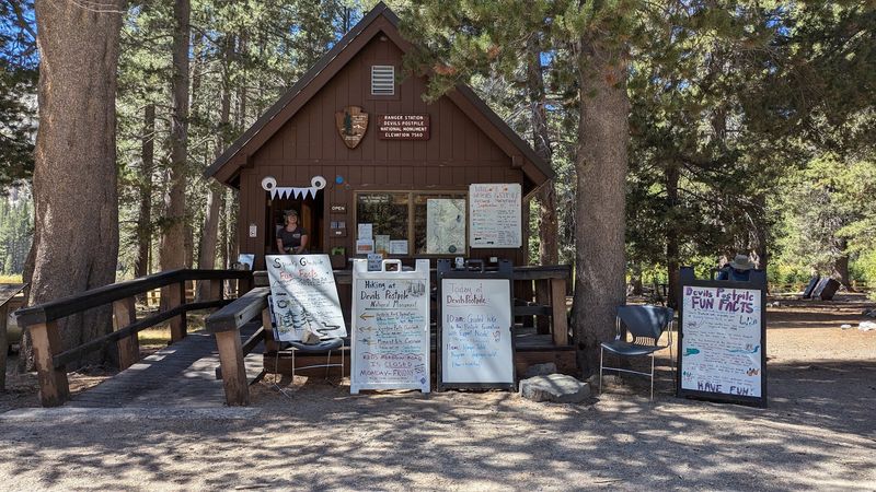
The ranger station is a valuable first stop. It offers information on trails, buses, and current conditions, along with restrooms and a water fountain.
The rangers have a reputation for being friendly and helpful. Many travelers count this among the best visitor stops they have found.
A two-minute chat at the counter can shape the whole day. It is the cheapest planning tool in the Sierra.
A Causeway Worth the Drive
Ireland can keep its ferry schedules and long-haul flights. California has its own stone columns, and they sit just outside Mammoth Lakes.
Devils Postpile packs a lot into a modest outing. The basalt wall, the polygon tops, Rainbow Falls, and quiet riverside corners all share one valley.
The trip works for families, longtime Sierra fans, and anyone curious about how the land was shaped. You can keep it short or stretch it into a full day.
Expect some logistics. Shuttles, seasonal access, small parking lots, and high elevation all require planning.
Still, the reward is hard to argue with. A short walk leads to a formation that has stood for about 100,000 years.
For Californians who love the classic road trip up Highway 395, this stop belongs on the list. It is proof that some of the best sights in the state still come with a modest shuttle fare and a little patience.
Grab a water bottle, catch an early bus, and let the columns do the talking.