
Affiliate disclosure: As an Amazon Associate I earn from qualifying purchases. Learn more
Long before highways crisscrossed Arizona, trains hauled copper, timber, and passengers across the desert and up into the high country. Many of those old rail lines have been reborn as smooth, mostly flat bike paths and rugged backcountry routes that let you pedal right through the state’s history.
For riders who want scenery without brutal climbing, these converted routes are some of the best-kept secrets in your own backyard. Here are 11 Arizona rail trails and old railroad corridors worth loading the bikes for this year, from cool pine forests near Flagstaff to sunny paths through Tucson and Prescott.
1. Flagstaff Urban Trail System, Flagstaff, Arizona
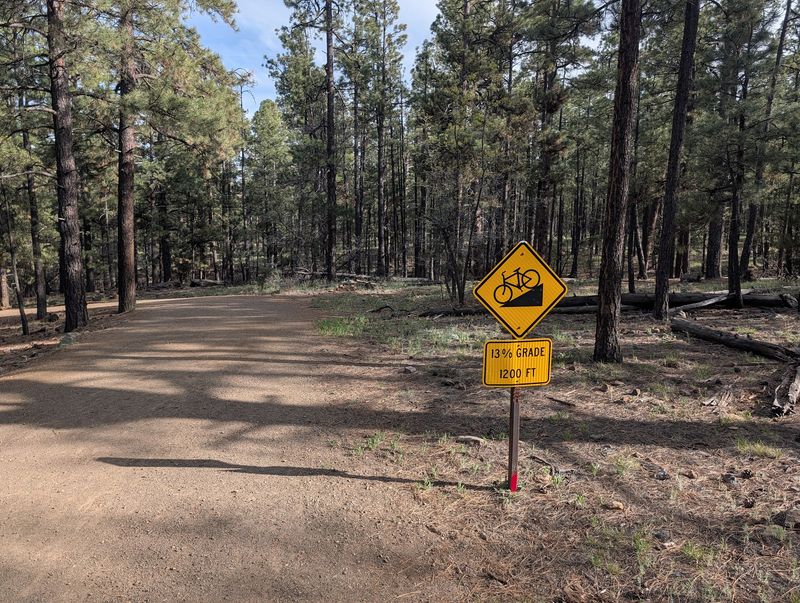
Cool pine air and mountain views make Flagstaff one of the best summer escapes for Arizona cyclists, and the Urban Trail System (FUTS) stitches the whole town together.
The network covers more than 50 miles of paved and unpaved routes, and several segments follow old rail alignments through the ponderosa forest. You can connect neighborhoods, parks, and downtown without fighting traffic.
At roughly 7,000 feet of elevation, temperatures here run far cooler than the Valley, so it is a natural pick when Phoenix bakes in July. Families like the gentle grades, while road riders use it to link up longer loops.
Parking and trail access points are scattered across town, and the paths are free to ride. Bring a light layer, since mountain mornings stay crisp even in summer.
2. Sonoran Bike Path and Loop Connections, Tucson, Arizona
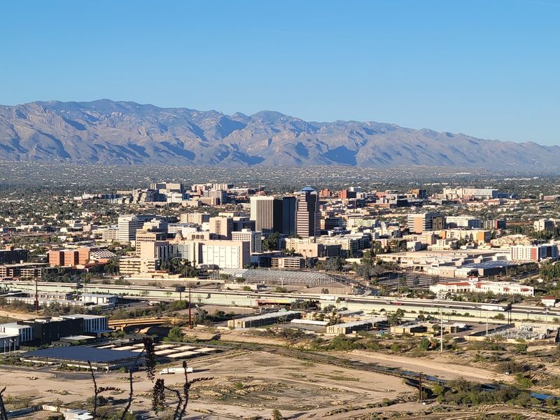
Tucson takes its cycling seriously, and the city’s paved paths tie into The Loop, one of the longest continuous car-free routes in the state.
The Loop stretches well over 100 miles around metro Tucson, following river parks and old corridors that once carried rail and canal traffic. Riders can pedal for hours without crossing a busy street.
Desert scenery here comes with saguaros, washes, and the Santa Catalina Mountains framing the horizon. Rest areas, water stops, and art installations dot the route.
Because it is mostly flat and fully paved, the path welcomes beginners, commuters, and long-distance riders alike. Winter and spring bring the most comfortable riding weather in the Old Pueblo.
3. Peavine Trail, Prescott, Arizona
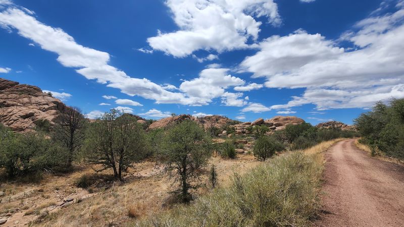
Granite boulders the size of houses line the Peavine Trail, and that dramatic rock scenery is what sets this old railroad route apart.
The path follows the former Santa Fe, Prescott and Phoenix Railway, whose winding curves earned the pea-vine nickname. Today it runs as a smooth, flat gravel trail perfect for hybrid and mountain bikes.
Riders pass Watson Lake and the Granite Dells, one of central Arizona’s most photographed landscapes. Birdwatchers often pause at the wetlands along the way.
The trail is family-friendly and connects to the nearby Iron King Trail for a longer outing. A small parking fee may apply at the trailhead, and the high-country elevation keeps summer rides pleasant.
4. Iron King Trail, Prescott Valley, Arizona
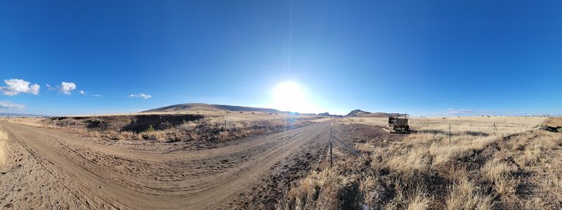
If the Peavine is the scenic showpiece, the Iron King is its practical partner, running along another stretch of the old mining railroad.
The route once served the Iron King Mine, hauling ore out of the hills, and now offers a flat gravel ride linking Prescott Valley toward the Dells. The two trails together create a longer point-to-point adventure.
Open high-desert grassland gives wide views of the surrounding peaks, and the grade stays easy the whole way. That makes it a solid choice for riders building distance without steep climbs.
Trailhead parking is available, and the path is free to use. Spring wildflowers can add color to the otherwise open terrain.
5. Chuck Huckelberry Loop Rillito River Park, Tucson, Arizona
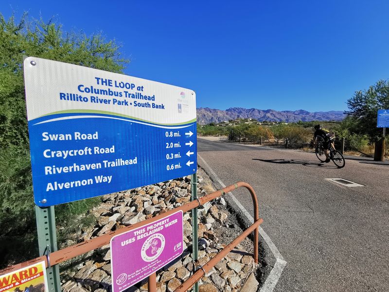
Named for a longtime county leader, the Chuck Huckelberry Loop is the official name for Tucson’s famous car-free network, and the Rillito River section is its beating heart.
The Rillito River Park path runs along a normally dry riverbed shaded in stretches by mesquite and cottonwood. It connects to the wider Loop, so short cruises easily turn into all-day rides.
The pavement is wide, smooth, and separated from traffic, which appeals to families and casual riders. Multiple access points make it simple to hop on for a mile or twenty.
Watch for early-morning riders and walkers, since this is one of the busiest and best-loved segments in the metro area. Cooler months bring the most crowds and the best weather.
6. Old Railroad Grade near Williams, Williams, Arizona
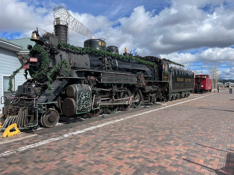
Route 66 nostalgia and steam-train history collide in Williams, the gateway town to the Grand Canyon Railway.
The area around Williams sits at high elevation in the Kaibab National Forest, where old logging and rail grades still cut through the pines. Forest roads following these gentle alignments give riders a quiet, shaded ride away from town traffic.
The historic Grand Canyon Railway still runs passenger trains north to the canyon, so the town keeps its rail heritage front and center. Cyclists can pair a ride with a stroll through the vintage downtown.
Summer temperatures stay mild thanks to the roughly 6,700-foot elevation. Check forest conditions and closures before heading out, as gravel grades vary in quality.
7. Santa Fe Trail, Douglas, Arizona
Down in Arizona’s southeastern corner, the border town of Douglas keeps a slice of its railroad past alive with a quiet local rail trail.
The former rail corridor gives residents a flat, straightforward path for walking and cycling through the wide grasslands of the Sulphur Springs Valley. It is a low-key ride far from the crowds of Sedona or Tucson.
Douglas grew up as a copper-smelting and railroad town, and the historic Gadsden district still shows off early-1900s architecture nearby. Cyclists can combine a trail spin with a look at the old downtown.
Big-sky views and sweeping mountain backdrops define the ride here. Winter and spring offer the most comfortable temperatures in this high-desert region.
8. Apache Railway Corridor near Snowflake, Snowflake, Arizona
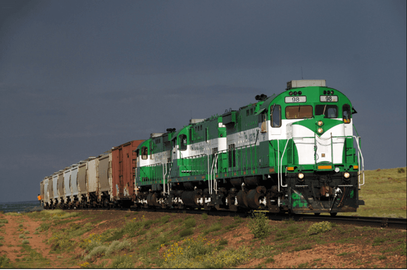
The little towns of Snowflake and Taylor sit along a route once served by the historic Apache Railway, a short line that hauled freight across the White Mountains region.
Old rail alignments and adjacent forest roads in this high plateau country give gravel riders open, uncrowded miles through juniper and pinyon. The elevation keeps summer rides more comfortable than the desert below.
Snowflake itself carries a distinctive pioneer history and tidy historic homes worth a slow roll through town. The surrounding countryside opens into classic northern Arizona ranch land.
Because these are working and rural corridors, riders should stick to legal public access and check local conditions. Clear skies here also make the region a favorite for stargazing after the ride.
9. Black Mesa Ranger District Rail Grades, Overgaard, Arizona
The Mogollon Rim country hides dozens of old logging railroad grades, and the Black Mesa area near Heber-Overgaard is one of the best places to find them.
Decades ago, timber companies built rail spurs to haul ponderosa logs out of these forests. Many of those flat, curving grades survive today as forest roads and unofficial routes perfect for mountain bikes.
Riders get tall pines, cool shade, and elevations around 7,000 feet that make summer riding a relief from Valley heat. Wildlife sightings are common in the quiet backcountry.
A forest map and current motor-vehicle-use maps help you stay on legal, open routes. Bring plenty of water, since services out here are limited.
10. Julian Wash Greenway, Tucson, Arizona
Public art and Tucson history give the Julian Wash Greenway a personality all its own among the city’s paths.
The paved greenway follows a desert wash and ties into the larger Loop system, running past interpretive markers that highlight the area’s agricultural and cultural roots. Sculptures and shade ramadas break up the miles.
Flat pavement makes it easy for families and new riders, and connections to other segments open up longer routes across the south side. It is a relaxed way to explore a less-touristed part of Tucson.
Access points come with parking, and the trail is free. Cooler-season mornings are the sweet spot for riding here.
11. Maricopa Trail Connections, Phoenix Metro, Arizona
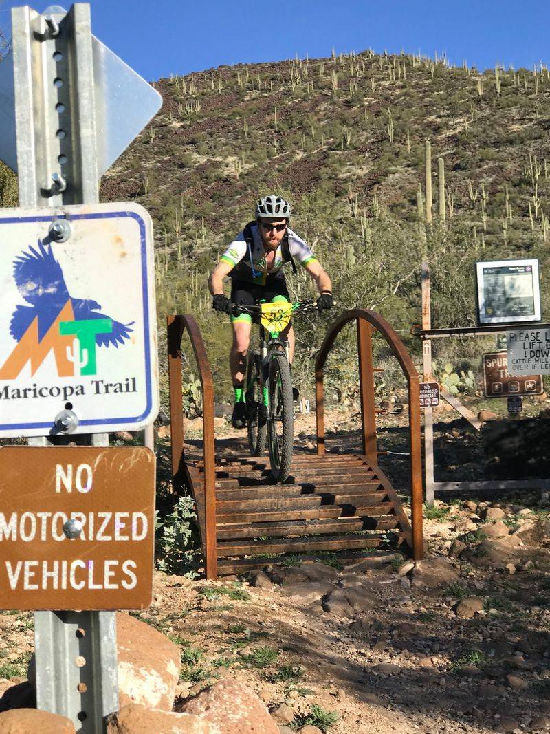
Ringing the entire Phoenix metro area, the Maricopa Trail links regional parks into a huge desert loop, and several stretches follow old canal and rail-style corridors.
The full system spans more than 300 miles connecting parks like White Tank, Estrella, and McDowell Mountain. Surfaces range from smooth to rugged, so riders can pick segments that match their bikes and skill.
Sonoran Desert scenery, saguaro forests, and mountain-park backdrops make even short rides feel like an outing. Golden-hour rides in the cooler months are especially popular.
Trailheads at the regional parks offer parking and water, though some parks charge an entry fee. Summer riders should start early and carry extra water, since Valley heat is no small thing.